- NASA-ISRO satellite enhances data on land subsidence.
- DWR to release new subsidence maps later this year.
- Improved monitoring to support sustainable groundwater use.
Saturday, October 11, 2025 — California’s understanding of how the ground shifts and sinks under the pressures of groundwater withdrawal just took a major step forward. On October 8, 2025, the California Department of Water Resources (DWR) announced that data from a new joint NASA–Indian Space Research Organisation (ISRO) satellite will soon expand the state’s ability to monitor land subsidence—one of the most visible signs of groundwater depletion.
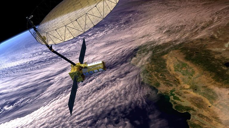
The NASA–ISRO Synthetic Aperture Radar, or NISAR, was launched in July and is designed to measure changes in the Earth’s surface with extraordinary precision. According to NASA, the radar can detect ground movement as small as a fraction of an inch. Over time, this capability will help track how agricultural regions, wetlands, and other landscapes respond to groundwater pumping and natural geologic shifts.
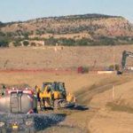
Why Subsidence Matters.
Subsidence—when land slowly sinks due to the compaction of underground layers—can cause serious damage to canals, levees, bridges, and water delivery systems. In some areas of California’s Central Valley, the ground has dropped several feet over recent decades. The new data from NISAR will help pinpoint where that movement is still occurring, allowing agencies to take early action before critical infrastructure is affected.
The DWR expects to receive satellite data later in 2025. Working with the NASA Jet Propulsion Laboratory’s OPERA project, DWR will produce and publish detailed maps showing subsidence trends. Once finalized, these maps will be available through the California Natural Resources Agency Open Data Portal and the Sustainable Groundwater Management Act Data Viewer for use by local water managers and the public.
Partnering for Deeper Insight.
NISAR is part of a growing network of tools being used to understand California’s complex groundwater systems. DWR is collaborating with the U.S. Geological Survey to map the geology of major groundwater basins and measure how water moves through them over time. The agency is also conducting Airborne Electromagnetic (AEM) surveys, expanding real-time monitoring sites, installing hundreds of groundwater wells, and developing advanced computer models to forecast basin health.
Together, these efforts provide a clearer picture of where groundwater is stored, how it fluctuates seasonally, and where the risk of further land subsidence is greatest.
Supporting Local Decision-Makers.
Beyond data collection, DWR has issued new Best Management Practices guidance to help local agencies address subsidence. The document offers strategies for reducing the impacts of sinking ground on communities that depend on groundwater. Public engagement is underway to refine the recommendations and ensure that local water managers have practical tools for implementation.
As California continues to experience climate extremes—ranging from severe drought to intense flooding—sustainable groundwater management remains a cornerstone of resilience. With the help of advanced satellite data and ongoing field research, DWR intends to keep improving how the state understands and manages its most essential hidden resource.
Image via the California Department of Water Resources: “This artist’s concept depicts the NISAR satellite in orbit over central and Northern California. Short for NASA-ISRO Synthetic Aperture Radar, NISAR is a joint mission of NASA and ISRO (Indian Space Research Organization).”
FAQ
What is land subsidence?
Subsidence occurs when the ground surface sinks due to the loss or compaction of materials underground, often caused by excessive groundwater pumping.
What is the NISAR satellite?
NISAR stands for NASA–ISRO Synthetic Aperture Radar. It is a joint Earth-observation mission by NASA and India’s space agency to track minute changes in the planet’s surface.
Why is subsidence a problem in California?
Subsidence can crack canals, damage levees, and reduce the capacity of flood-control and irrigation systems, leading to costly repairs and reduced water delivery.
When will the new data be available?
The DWR expects to begin receiving usable data from NISAR later in 2025, with public maps released soon after.
How does this support groundwater sustainability?
By providing precise, up-to-date information about land movement, water managers can better balance pumping, recharge, and conservation to prevent long-term damage to aquifers and infrastructure.