- Globe and Miami, Arizona, were flooded twice in October.
- Salt Lake City also saw back-to-back floods and record rain.
- Vallecito, Colorado, endured “historic” flooding and evacuations.
- Reservoirs caught some runoff, but major lakes barely budged.
- Flash floods rarely refill aquifers, but they do reshape rivers.
Thursday, October 16, 2025 — When Hurricane Priscilla’s remnants swept across the Southwest in mid-October, they met some landscapes that were already drenched. From Arizona to Utah, communities were still drying out from earlier downpours when another round of tropical moisture turned creeks into rivers and roads into lakes. For some towns, it wasn’t just déjà vu — it was a double disaster. Here’s a brief roundup of the Colorado River Basin’s big weather event that happened this past weekend:
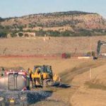
Arizona: Globe–Miami’s Two Floods.
In Arizona’s Gila County, the twin towns of Globe and Miami became the symbol of back-to-back flooding.
At the end of September, torrential rains caused flash floods that killed three people, washed away propane tanks, and shut down U.S. 60. The state declared an emergency as residents dug mud from their homes and businesses.
Just a couple weeks later, another surge of tropical rain from Hurricane Priscilla and Storm Raymond hit the same area. Streets flooded again, repairs were undone, and relief teams returned to the same neighborhoods. Local officials said it felt like starting recovery all over again.
Other highlights from Arizona:
-
The Phoenix metro logged one of its wettest Octobers on record; NWS confirmed multiple days of storms with widespread flood alerts. https://www.axios.com/local/phoenix/2025/10/14/phoenix-october-storms-rainfall

-
Flood watches and warnings covered most of Arizona as deep tropical moisture surged in (NWS/WPC). https://www.wpc.ncep.noaa.gov/metwatch/metwatch_mpd_multi.php?md=1181&yr=2025
-
Roads in the City of Maricopa and surrounding Pinal County went underwater, with flash-flood warnings in effect. https://www.inmaricopa.com/roads-underwater-as-heavy-sunday-morning-rain-slams-maricopa/
-
NWS flagged significant risk for 2–4 inches in parts of AZ; additional moisture arrived with Raymond. https://www.axios.com/2025/10/10/us-southwest-us-rain-flood-threats-storms
-
SRP pre-emptively moved water: continuing ~1,800 cfs releases from Horseshoe Dam into Bartlett Lake through Oct. 20, noting storm-driven variability and potential lake rises. https://www.watershedconnection.com/
-
SRP’s daily water report reiterated the same operations and potential inflow variability from the storms. https://streamflow.watershedconnection.com/dwr
-
Forecast and flood-risk overview (Flagstaff area emphasis). https://apnews.com/article/941fb0e978a28e41703122925bced707
Quick take: Urban flooding and scattered infrastructure impacts (road closures, water rescues) were widespread; SRP’s pre-emptive reservoir operations suggest stormwater capture, though major Salt-Verde storage shifts will be clearer after inflow accounting.
California: Rare October Soaking.
Southern California doesn’t usually get tropical storms in October, but this year’s weather broke the rules. The remnants of Hurricane Priscilla poured inches of rain onto mountain slopes and deserts alike, triggering flash-flood rescues and brief evacuations in Los Angeles and Riverside Counties. Stormwater channels ran full, but the brief burst hardly dented the long-term dryness of the Lower Colorado Basin.
-
Remnant Priscilla set up a rare mid-October SoCal storm; NWS/LA Times signaled rain and thunderstorms Thu–Sat (Oct. 9–11). https://www.latimes.com/california/story/2025-10-09/socal-moisture-hurricane-priscilla
-
By Oct. 14, SoCal saw heavy rain, mudslide risk on burn scars, rescues on the L.A. River, and short-lived evacuations (115 homes). https://apnews.com/article/c3aa0d54871d9d2de9fe17d844252612
-
Forecast packages from local TV mets/NWS: localized 0.5–1.5″ lowlands, up to ~4–5″ mountains. https://www.cbsnews.com/losangeles/news/southern-california-los-angeles-orange-county-rain-tropical-storm-priscilla/
-
WeatherWest briefed that Priscilla’s remnants would extend into far SoCal, with a larger mid-October cold-core system to follow. https://weatherwest.com/archives/43542
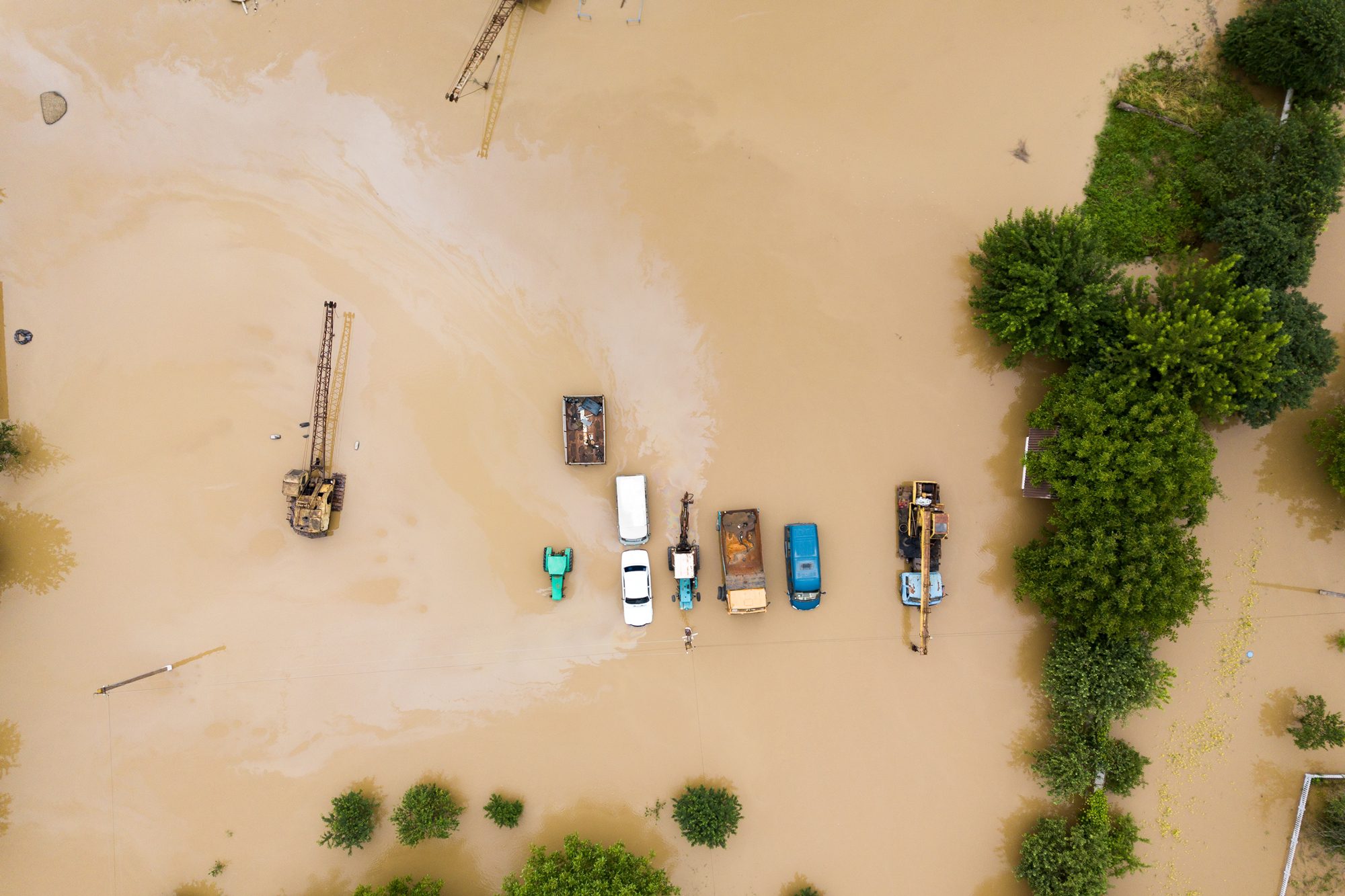
Colorado: Vallecito Reservoir Holds the Line.
Southwestern Colorado saw “historic” flooding around Vallecito Creek near Durango, where hundreds of residents were evacuated. Roads washed out, and local rivers roared higher than anyone could remember. Yet nearby Vallecito Reservoir had enough spare capacity to catch much of the runoff, showing how smaller reservoirs can sometimes blunt the damage even as nearby creeks overflow.
-
Southwestern Colorado (La Plata/Archuleta) saw historic flooding: hundreds of homes under evacuation, with Vallecito Creek surging. https://apnews.com/article/e6b57480a15dfae3b61fa375baa6f027
-
Colorado Sun: October precip at 512% of normal in SW Colorado from Priscilla + Raymond; one small reservoir in La Plata County doubled its volume. https://coloradosun.com/2025/10/14/rain-southwestern-colorado-san-juan-river-vallecito/
-
CBS Colorado compiled damage in Vallecito & Pagosa Springs (“historic floods”). https://www.cbsnews.com/colorado/news/historic-floods-southwestern-colorado-vallecito-pagosa-springs/
Water supply: Rapid inflows boosted some small reservoirs and tributaries; large-system benefits (Powell/Mead) will lag and depend on sustained basin-wide runoff.
New Mexico: Flash Floods in the Desert.
In northwestern New Mexico, the San Juan County area near Farmington flooded quickly as Priscilla’s moisture moved north. Roads disappeared under sheets of water, and rescue teams pulled drivers from stalled vehicles. The storms sent rare flow down normally dry washes, but most of that water raced away instead of soaking into the ground.
-
San Juan County flash flooding (northwest NM): vehicles swept away; rescues documented by local officials and media. https://www.foxweather.com/extreme-weather/flash-flooding-new-mexico-desert-southwest-tropical-rain
-
Watchers/County imagery and reports of flash floods Oct. 10–12 tied to Priscilla. https://watchers.news/2025/10/12/remnants-of-priscilla-trigger-flash-floods-in-new-mexico-u-s/
-
NWS Albuquerque Key Messages (Oct. 15): flooding concerns on creeks/arroyos; Animas and San Juan near Farmington flagged for minor flood impacts. https://forecast.weather.gov/product.php?issuedby=ABQ&product=AFD&site=NWS
Aquifers: Focused recharge from flows in ephemeral channels is a known pathway in NM/AZ; however, flash floods often run off quickly—net recharge varies by geology/soils. (USGS/NMWRRI background) https://nmwrri.nmsu.edu/publications/technical-reports/tr-documents/tr392.pdf | https://pubs.usgs.gov/pp/pp1703/ | https://pubs.usgs.gov/of/2005/1023/pdf/ofr20051023.pdf
Nevada: Fast Water, Little Storage.
Las Vegas had its own drama when sudden floods swept through desert washes near the Strip, prompting swift-water rescues. Despite the intensity, Lake Mead barely moved. The Bureau of Reclamation’s gauges showed only a few hundredths of a foot of change — a reminder that even massive local storms are tiny compared with the volume of the great Colorado River reservoirs.
-
Las Vegas Valley: swift-water rescues near the Strip after washes rose; one person initially unaccounted for. https://www.reviewjournal.com/local/local-las-vegas/2-rescued-1-missing-after-rain-deluges-wash-near-las-vegas-strip-3484746/
-
Regional flood watches extended into eastern NV as the plume spread (WaPo overview including eastern Nevada). https://www.washingtonpost.com/weather/2025/10/09/southwest-flooding-rain-arizona/
Lake Mead: Minimal immediate movement attributable to the storm pulse (see USBR dashboards + daily tracker above). https://www.usbr.gov/lc/region/g4000/hourly/levels.html | https://mead.uslakes.info/level.asp
Utah: Salt Lake’s Record October.
In Utah, Salt Lake City faced two rounds of flooding in as many weeks.
The first came October 3–4, when about two and a half inches of rain fell in fourteen hours. A drainage canal overflowed and flooded more than two dozen homes on the city’s west side, prompting a state of emergency.
Before cleanup was complete, the remnants of Priscilla dumped more rain, pushing Salt Lake City past its all-time record for the wettest October ever recorded. Farther south, places like Pine Valley and New Harmony saw five inches of rain overnight, sending torrents off burn scars and ripping up roads.
-
Salt Lake City declared a state of emergency for west-side neighborhoods after a drainage canal overflowed; >2 dozen homes impacted. https://www.axios.com/local/salt-lake-city/2025/10/07/flood-emergency-mayor-erin-mendenhall-west
| City notice: https://www.slc.gov/blog/2025/10/07/salt-lake-city-declares-state-of-emergency-to-help-westside-residents-after-flooding/ -
KUTV: SLC broke its wettest October on record by Oct. 14 (4.16″). https://kutv.com/news/local/salt-lake-breaks-all-time-record-for-amount-of-rain-in-october-two-weeks-into-month
-
KSL: statewide totals surged from Priscilla’s moisture; drought persists in parts of the state despite soaking. https://www.ksl.com/article/51389365/hurricane-priscilla-brought-big-rain-totalsto-utah-and-more-rain-in-the-forecast
-
Four Corners stations reported up to a third of annual rainfall in a day at some points (context piece). https://www.ksjd.org/podcast/ksjds-outdoor-report/2025-10-15/heavy-rain-brings-flooding-but-drought-still-defines-the-four-corners
Great Salt Lake / storage: Record rain provides delayed, positive contribution potential; near-term lake response is typically lagged. (Context explainer) https://www.yahoo.com/news/articles/record-rainfall-delayed-positive-impact-035738395.html
Wyoming: On the Edge.
Wyoming sat mostly north of the main storm track. Scattered showers and lightning were the main story there, while neighboring states endured the brunt of Priscilla and Raymond’s flooding.
-
NWS Riverton noted additional showers/thunder mid-week as remnants of Raymond filtered northeast; primary flood impacts focused south of WY. https://forecast.weather.gov/wwamap/wwatxtget.php?cwa=riw&wwa=hazardous+weather+outlook
Net: Wyoming saw peripheral precipitation with limited reported damage; no immediate major reservoir/aquifer signal reported as of Oct. 15.
Reservoirs, Rivers, and Recharge.
For all the chaos, these storms delivered only modest long-term water gains. Smaller headwater reservoirs briefly rose, but giant lakes like Powell and Mead barely registered a blip. The reason is scale: it takes months of sustained runoff to shift those levels, not a week of tropical rain.
And while flash floods can fill arroyos and washes, most of that water runs off too fast to soak into the deep aquifers that supply wells across the Southwest. The real hydrologic benefit may come later — if wet soils and cooler weather set up better snowpack recharge this winter.
Watch the Gauges:
- Hourly reservoir levels – U.S. Bureau of Reclamation
- Weekly basin report – Reclamation Hydrology Summary (PDF)
- Colorado River Operations – RiverOps Dashboard