
- National Ground Water Association unveils an online map with data on more than 14 million wells in the United States.
- The map offers open access to information such as depth, age, and water quality.
- The tool helps both homeowners and professionals make better water decisions.
Wednesday, October 22, 2025 — Have you been wondering about that old well at the property you’re thinking about buying? Now you can easily find out in just a few minutes without having to know how to navigate a government website. The National Ground Water Association (NGWA) and its educational platform WellOwner.org announced on October 15, 2025, the launch of a new digital tool designed to make water well data easier to find and understand.
The NGWA Water Well Map contains information on more than 14 million wells across the United States, offering details about each well’s location, depth, construction date, and water quality. For the first time, the public can view this information in one place, free of charge, through the WellOwner.org website.
A Tool for Homeowners and Communities.
For everyday users, the map provides transparency about local groundwater conditions. Homeowners can see whether wells in their area are deep or shallow, compare water quality trends, and understand how aquifer levels may affect their water supply.
NGWA Chief Executive Officer Terry S. Morse said the organization was proud to make this data widely accessible. “Water wells remain one of the most important pieces of our nation’s water infrastructure, especially in rural areas,” Morse said. “Providing greater access to data supports professionals in the field and empowers millions of Americans who rely on private wells to better understand and protect their water resources.”
According to the U.S. Geological Survey, more than 43 million Americans depend on private wells for their drinking water. Agriculture alone uses an estimated 400,000 wells to irrigate crops and supply livestock.
Support for Water Professionals.
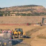
The tool also benefits water well drillers, engineers, and other industry experts. With changing clean energy tax credits, state regulations, and tariff policies, well installation costs can be unpredictable, sometimes reaching $40,000 or more. The NGWA Water Well Map provides professionals with reliable reference data to estimate drilling depths, forecast expenses, and evaluate aquifer conditions more accurately.
The association stated that this map strengthens the nation’s ability to manage its groundwater sustainably by giving both citizens and experts access to better information.
Public and Member Versions Available.
The public version of the Water Well Map can be accessed for free on WellOwner.org. A more advanced version—featuring comparison tools, cost estimators, and enhanced data sets—is available to NGWA members through NGWA.org and integrated within the organization’s Business PRO management platform.
FAQ
What is the NGWA Water Well Map?
It is a digital map created by the National Ground Water Association that displays information on more than 14 million U.S. water wells, including their depth, location, and water quality.
Who can use the map?
The public version is open to anyone, including homeowners and local officials. A more advanced version is available to NGWA members and groundwater professionals.
Why is this important?
The map improves public understanding of groundwater conditions and helps professionals plan new wells more efficiently. It also supports informed water management and sustainability efforts nationwide.
Where can the map be found?
The public version is available at WellOwner.org, while the expanded version is offered through NGWA.org.
How many Americans use private wells?
Roughly 43 million people depend on private wells for drinking water, and the agricultural sector operates about 400,000 wells across the country.

This map is an excellent tool to start. I’m not sure how thorough it is but I’ve found quite a bit of info so far. NGWA did an impressive job.