- Heavy early-season rain improved parts of California and Utah.
- Severe drought persists across portions of Arizona and Colorado.
- Abnormally dry or worse conditions cover 72 percent of the U.S.
- Federal shutdown does not affect Drought Monitor releases.
Saturday, October 25, 2025 — Despite the federal government shutdown, the U.S. Drought Monitor map and its associated products remain unaffected and will continue to be released on schedule.
As of October 23, 2025, weather across the Lower 48 states has been anything but uniform. The past month brought over eight inches of rain to isolated pockets of New England, the Ohio Valley, and parts of the West Coast. At the same time, large areas of the central and southern Plains, interior West, and desert Southwest saw little more than a trace of moisture.
That uneven pattern produced another week of sharp contrasts in the national drought picture. Some regions, including parts of the West and Ohio Valley, saw measurable recovery. Others—particularly the southern Plains, Gulf Coast, and much of the Southeast—slipped deeper into drought.
Nationwide, about 72 percent of the contiguous United States is classified as abnormally dry or worse, a slight improvement from 74 percent the previous week. Roughly 21 percent of the country remains in severe drought or worse (D2–D4), down from 23 percent. When including all 50 states and Puerto Rico, dryness declined to just under 60.5 percent coverage.
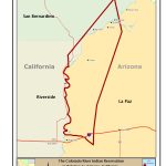
Conditions in the Colorado River Basin.
Arizona.
Central Arizona received beneficial rainfall, with localized totals topping several inches in higher elevations. Those rains helped trim drought coverage slightly. Still, many lower-elevation desert areas remain parched after another month of minimal precipitation, continuing moderate to severe drought conditions.
California.
October has been unusually wet for much of central and southern California. Several Pacific storm systems brought early rain and snow, producing notable improvement on the Drought Monitor. Large portions of the Great Basin and Sierra Nevada recorded better soil moisture, with some areas now removed from drought altogether. The report notes that “October so far has been wetter than most such months on record” in parts of central and southern California.
Colorado.
Southwestern Colorado benefited from the same storms that helped California and Utah, reducing the coverage of severe drought. However, central Colorado continues to show pockets of extreme drought, and the state remains sensitive to further precipitation deficits as the snow season begins.
Nevada.
Much of Nevada experienced modest improvement following scattered rains in the Great Basin. The overall drought footprint has shrunk, though several counties in the south and east continue to register moderate to severe dryness.
New Mexico.
Precipitation has been mixed across New Mexico. Northern areas near the Colorado border received moderate rainfall, while the south and east stayed largely dry. These conditions have kept the state in a patchwork of moderate to severe drought, with only localized short-term relief.
Utah.
Utah stands among the week’s success stories. Both the western and eastern parts of the state benefited from substantial precipitation, and drought coverage declined accordingly. The U.S. Drought Monitor reported improvement “in the western and eastern tiers of Utah,” with fewer areas remaining in the more intense categories.
Wyoming.
Most of Wyoming saw one to three inches of rain last week, particularly in central and eastern sections. That moisture cut the state’s extreme drought nearly in half—from about 3 percent to less than 2 percent of the region. The heaviest dryness now lingers in small pockets of southwestern Wyoming.
Regional Snapshot.
Across the High Plains, coverage of dryness and drought remains considerably lower than in other regions—just over 36 percent of the area. Extreme drought (D3) now affects roughly 1.7 percent, down from 3.3 percent the previous week.
In the West, total dryness (D0–D4) decreased from 80 percent to a little over 74 percent. The most intense drought (D4) has retreated to a small section of north-central Idaho, while much of the Colorado River Basin saw improvement.
Looking Ahead.
The next seven days are expected to reinforce that pattern of regional extremes. The Pacific Northwest and parts of Texas and the Lower Mississippi Valley could see between three and five inches of rain, while much of the interior West—including the Southwest and Great Basin—may receive little to none.
Forecasts call for below-normal daytime highs from California through the northern Rockies, and warmer-than-average nights across most of the Plains and Southwest. Looking further out, the Climate Prediction Center’s 6-to-10-day outlook (valid October 29 to November 1) favors continued wet weather in the Pacific Northwest and much of the Rockies, with dryness persisting from eastern Arizona through west Texas.