- Land subsidence is shrinking canal capacity in the San Joaquin Valley.
- A new “Big Notch” project opens floodplain habitat for salmon and sturgeon.
- The State Water Project begins 2026 with a cautious 10 percent allocation.
- Statewide reservoir storage starts the season slightly above average.
Tuesday, December 2, 2025 — As California turns the page into the 2026 water year, three recent decisions from the Department of Water Resources show how the state is trying to keep water moving, protect rivers and fish, and manage risk in a volatile climate.
In late November 2025, the Department of Water Resources released a major study on how sinking ground can affect canals and aqueducts in the San Joaquin Valley, one of the country’s most productive farming regions and home to more than four million people. The study concludes that stabilizing groundwater levels and repairing existing canals is more important than building new conveyance projects.
Just days earlier, the Department celebrated the first operating season of the Big Notch Project in Yolo County, a large-scale effort to reconnect salmon to their historic floodplain habitat while still protecting farming and flood control.
On December 1, 2025, the agency set the first State Water Project allocation of the new water year at 10 percent of requested supplies, a conservative starting point as the winter storm season begins.
Together, these moves highlight how California is trying to shore up aging infrastructure, restore damaged ecosystems, and manage supplies with more caution as climate swings grow sharper.
Study Finds Sinking Ground Threatens Valley Canals.
On November 24, 2025, the Department of Water Resources released the San Joaquin Valley Conveyance Study , a detailed look at how land subsidence is affecting canals, aqueducts, and other facilities that move water across the valley.
The study points to a clear conclusion. The first priority for improving water delivery in the San Joaquin Valley is not new canals, but stopping or slowing land subsidence, especially near State Water Project and Central Valley Project facilities. That can only happen over time if groundwater levels rise and stay above critical thresholds.
Officials also found that repairing existing canals generally provides more benefit than building new conveyance, because surface water supplies are limited. In other words, there is usually not enough extra water available to justify large, new delivery systems.
What Subsidence Looks Like on the Ground.
Decades of pumping groundwater faster than it can be replenished have caused some of the most severe subsidence in the country. As the land slowly collapses, canal bottoms sink and slopes change, reducing the amount of water the canals can carry.
Key findings from the study include:
-
Parts of the San Luis Canal have dropped by more than eight feet since the 1960s.
-
Subsidence measured in 2023 has cut the carrying capacity of the California Aqueduct by about 44 percent in some reaches.
-
In 2017, more than ten feet of subsidence in certain stretches of the Friant–Kern Canal reduced deliveries by about 300,000 acre-feet.
Loss of canal capacity makes it harder to capture and move high flows during wet years. When floodwater cannot be moved or stored efficiently, communities and farms are more likely to rely on already-stressed groundwater, which can deepen subsidence and increase long-term risks to public safety and the economy.
Limited Surface Water, Limited Room for New Projects.
The study also notes that many of the valley’s major canals and aqueducts rarely run at full capacity. That is a sign that water availability, not canal size, is the main constraint. Under these conditions, expanding conveyance provides only limited value, while repairing existing systems and stabilizing the land beneath them can deliver more immediate benefits.
The conveyance report follows the State Water Project Adaptation Strategy and is part of a series of studies on how climate change will affect the San Joaquin Valley’s water future. The next report in the series, the San Joaquin Basin Flood-Managed Aquifer Recharge Watershed Studies, is expected in December 2025 and will examine how floodplain recharge can support groundwater, flood management, ecosystems, and community needs.
Big Notch Project Opens Floodplain Habitat for Salmon.
On November 21, 2025, the Department of Water Resources held a ribbon-cutting event in Yolo County to launch the first operational season of the Big Notch Project.
The project modifies the Fremont Weir at the upper end of the Yolo Bypass, a major floodplain west of Sacramento. Three operable gates allow the state to route water from the Sacramento River into the bypass with greater precision, creating shallow, slow-moving floodplain habitat when river levels are high enough.
This kind of habitat is critical for juvenile Chinook salmon and green sturgeon, which are listed under state and federal endangered species laws. The Yolo Bypass also remains a working landscape that supports agriculture, recreation, and flood protection, so managers must balance fish needs with local land uses.
 held a ribbon-cutting ceremony in Yolo County to kick off the first operational season of the Big Notch Project.
How Big Notch Works.
Construction on the Big Notch Project involved removing a section of the Fremont Weir, installing three new gates, excavating roughly 180,000 cubic yards of soil and sediment to create new channels, and building a control structure and pedestrian bridge.
With this work complete, managers will open the gates when Sacramento River levels are high enough for the Yolo Bypass to act as a floodplain. Water will move through the notch in the weir, spreading into shallow areas where young salmon can feed and grow before heading downstream.
Studies have shown that juvenile salmon rearing on floodplains grow faster than those that stay in the main river channel. Biologists sometimes refer to these larger juveniles as “floodplain fatties,” and the extra growth is linked with higher survival rates on the journey to the Pacific Ocean.
Adult salmon and sturgeon should also see benefits. The new openings are expected to reduce stranding and delays that can occur when fish encounter barriers during migration. Sonar cameras at the gates will track which species use the structure and how often they pass through.
Project Cost and Partnerships.
The Big Notch Project cost about $58 million for construction, oversight, and environmental monitoring. The United States Bureau of Reclamation contributed approximately 41 million dollars as the federal lead agency.
Other partners include the Yocha Dehe Wintun Nation, the California Department of Fish and Wildlife, the National Marine Fisheries Service, Yolo County, and local landowners. The project also helps meet regulatory requirements that allow continued operation of both the State Water Project and the federal Central Valley Project, which together supply water to millions of residents and large areas of farmland.
State Water Project Starts 2026 With 10 Percent Allocation.
On December 1, 2025, the Department of Water Resources announced an initial State Water Project allocation of 10 percent of requested supplies for calendar year 2026.
This first allocation is a contractual requirement each year and is based on early season conditions. It reflects current reservoir storage, observed fall precipitation, and a cautious assumption that the rest of the water year could be dry.
The State Water Project delivers water to 29 public water agencies that serve about 27 million people and irrigate roughly 750,000 acres of farmland across California.
Hydrology and Reservoir Conditions.
As of December 1, the wet season is described as off to a good start. Northern California has received beneficial rainfall, and parts of Southern California have seen significant rain following a dry year.
According to the Department of Water Resources:
-
Statewide reservoir storage sits at about 114 percent of average for this time of year.
-
Lake Oroville, the largest State Water Project reservoir, is at roughly 100 percent of average and slightly above its level in December 2024.
Last year, the State Water Project’s initial allocation was five percent and was gradually increased to 50 percent by the end of the season. Whether something similar happens this year will depend on the strength and timing of winter storms and the amount of mountain snowpack that develops.
How Allocations Change Over Time.
The Department of Water Resources reviews conditions throughout the winter and spring. Allocations are typically updated each month as snowpack, rainfall, and runoff data are analyzed, with final numbers usually set in May or June.
If rain and snow totals remain modest, the allocation could stay low. If California experiences a wet winter with strong runoff, the allocation may increase. The December 1 announcement is therefore a starting point rather than a final decision on how much water State Water Project contractors will receive in 2026.
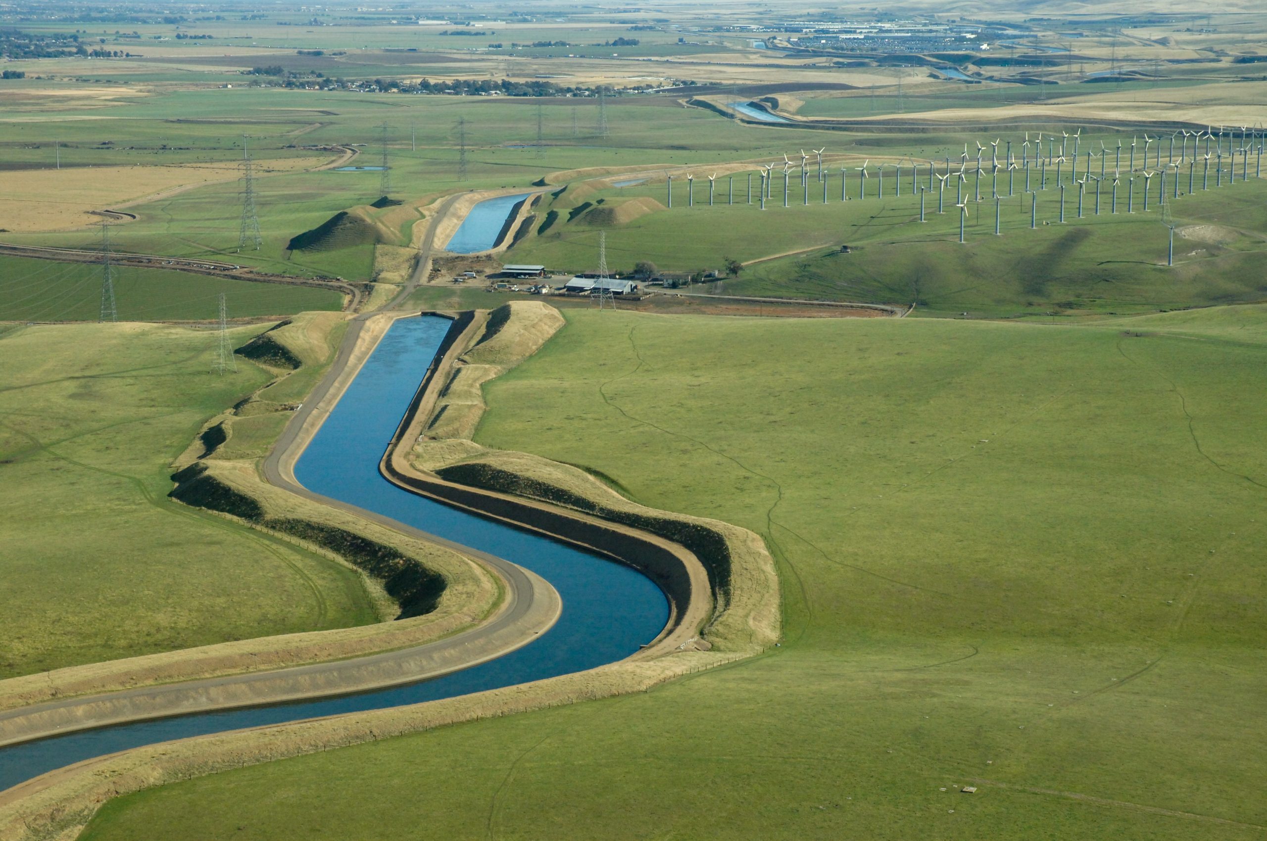
Image Credit (Header) — California Department of Water Resources. The Delta–Mendota Canal is a 117-mile-long aqueduct in central California, United States. The canal was designed and completed in 1951 by the U.S. Bureau of Reclamation as part of the Central Valley Project to supply freshwater to users downstream of the San Joaquin River.
Frequently Asked Questions
Q1: What is land subsidence and why does it matter for water delivery?
Land subsidence occurs when the ground surface sinks due to subsurface materials compacting. In the San Joaquin Valley, this is often caused by long-term groundwater pumping that exceeds natural recharge. When canals and aqueducts are built on land that sinks unevenly, their slopes change, and capacity drops.
Q2: Why does the San Joaquin Valley Conveyance Study prioritize groundwater stabilization over new canals?
The study concludes that stabilizing groundwater levels so the land stops sinking is the most effective way to protect existing canals and aqueducts. It also notes that many facilities are not operating at capacity, suggesting that water availability, not canal size, is the main limiting factor. Under those conditions, repairing and protecting current infrastructure provides more benefit than building new conveyance projects.
Q3: What is the Big Notch Project and where is it located?
The Big Notch Project is a major fish and floodplain restoration effort built into the Fremont Weir at the head of the Yolo Bypass in Yolo County. It includes three operable gates, new channels carved into the floodplain, and a control building and pedestrian bridge.
Q4: How does Big Notch help endangered fish like salmon and sturgeon?
When the gates are open, water spreads across the Yolo Bypass floodplain, where young salmon can find warmer, food-rich shallow water. Research has shown that fish rearing on floodplains grow faster and have higher survival rates. The new openings also help adult salmon and sturgeon by reducing barriers and delays during migration. Sonar cameras track fish usage.
Q5: What is the State Water Project and who relies on it?
The State Water Project is a statewide system of dams, reservoirs, pumping plants, and canals operated by the Department of Water Resources. It supplies water to 29 public agencies that collectively serve about 27 million people and roughly 750,000 acres of farmland.
Q6: Why is the initial 2026 State Water Project allocation only 10 percent?
The initial allocation is set early in the water year before major winter storms arrive. It is based on current reservoir storage, early precipitation, and conservative planning assumptions. Allocations can rise if rain and snow accumulate through the winter and spring. Last year’s allocation increased from five percent to 50 percent by the end of the season.
Q7: How will these developments affect local communities and agriculture in the near term?
In the short run, the San Joaquin Valley conveyance findings highlight ongoing risks from subsidence and the need for continued groundwater management and canal repairs. Big Notch should begin providing habitat benefits for fish while maintaining flood protection and farmland in the Yolo Bypass. The 10 percent initial State Water Project allocation signals a cautious approach to deliveries; communities and irrigation districts that rely on State Water Project supplies will watch monthly updates to see whether allocations rise as the winter progresses.