
February 6, 2023 – It’s a temporary fix, but Utah’s governor hopes that by raising the Great Salt Lake Causeway berm five feet, the state will have a temporary fix until a permanent plan to stave off ecological disaster is negotiated.
Friday, Utah Gov. Spencer Cox announced that he issued Executive Order 2023-02 directing the Utah Division of Forestry, Fire and State Lands to raise the berm. “The Great Salt Lake is crucial to our environment, ecology and economy, and we must do everything we can to protect it,” said Gov. Cox . “We’ve been blessed with significant snowpack so far this winter, and this executive order will allow the state to move quickly to increase the lake level in the South Arm by capturing spring runoff. We don’t want to miss this opportunity to safeguard the lake.”
The Great Salt Lake is owned and managed by the state of Utah as sovereign land held in trust for the public. On Nov. 3, 2022, the Great Salt Lake reached a historically low surface level elevation of 4,188.5 feet (provisional USGS data). The lake levels are causing a significant increase in salinity, threatening the Great Salt Lake ecosystem, according to the Governor’s press release.
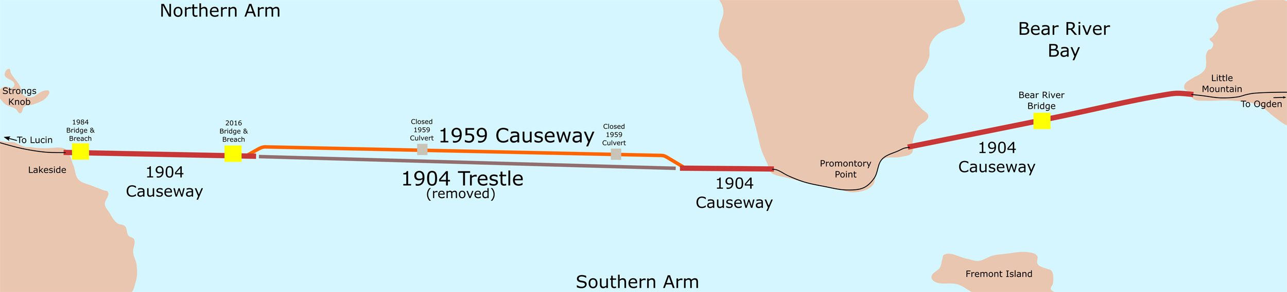
The Union Pacific Railroad Causeway bisects the Great Salt Lake into what is referred to as the North Arm and South Arm. The Utah Division of Forestry, Fire and State Lands controls a water flow berm currently set at 4,187 feet. Under Executive Order 2023-02, effectively immediately, the Utah Division of Forestry, Fire, and State Lands will increase the berm height to a minimum of 4,192 feet in order to increase the overall depth and decrease the salinity of the South Arm of the Great Salt Lake.
In addition, the Department of Natural Resources and Department of Environmental Quality will immediately prepare a berm management plan to guide future adjustments to berm height.
The order will expire upon adoption and implementation of the berm management plan.
Header Image:
A November 2016 map of the railroad causeway crossing the Great Salt Lake, showing causeway parts, along with some geographical highlights of the area. By Beneathtimp via Wikimedia Commons  and Creative Commons License.