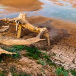
- A late-season storm brought only modest drought relief to parts of northern California, leaving conditions largely unchanged across the broader West.
- Low streamflows linked to poor snowmelt recharge are beginning to emerge as a concern across the West, including the Great Basin region.
- Southwestern Colorado saw drought conditions worsen during the reporting period, even as the eastern Colorado Plains received some beneficial rain.
- Dry conditions are expected to persist across most of the West in the week ahead, with above-normal temperatures forecast to follow.
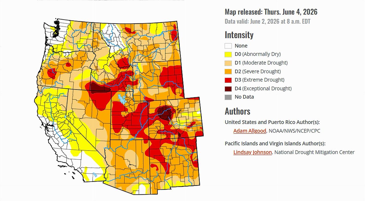
Saturday, June 6, 2026 — As June arrived, the United States presented a patchwork of extremes. Soaking rains brought widespread relief to the South and Southeast, where some areas recorded 150 to 300 percent of their normal May precipitation. Meanwhile, scorching temperatures baked the northern Plains and upper Midwest, pushing drought conditions rapidly in the wrong direction. The story in the West — home to the seven states that share the lifeblood of the Colorado River — was quieter, but no less significant.
A Storm That Promised More Than It Delivered.
A late-season storm system moved through the region during the week ending June 3, 2026, dropping heavy rainfall across southern Oregon and northern California. On the surface, that sounds like good news. But according to the United States Drought Monitor’s June 4 report, the storm produced only a few modest improvements and did little to meaningfully change the drought picture across the West.
In California — one of the seven Colorado River Basin states and a major water user under the river’s allocation agreements — some areas actually saw conditions worsen despite the storm’s presence. Degradations were recorded in parts of the state, a reminder that a single weather event, however welcome, cannot unwind months of deficit on its own.
The Snowmelt Problem.
Perhaps the most telling detail in this week’s report is what it says about snowmelt — or, more precisely, the lack of it. Across the West, including the Great Basin region that spans parts of Nevada and Utah, impacts from poor snowmelt recharge are beginning to show up in the form of unusually low streamflows.
Snowpack in the mountains of the Colorado River Basin serves as a natural reservoir, storing winter precipitation and releasing it slowly into rivers and streams as temperatures rise in spring and early summer. When that snowpack is thin or disappears too quickly, river flows suffer — and with them, the water supplies that farms, cities, and ecosystems depend on across seven states and parts of Mexico.
The Drought Monitor report notes that these streamflow impacts are only beginning to be felt, suggesting the effects may deepen as summer heat intensifies.
Mixed Signals in Colorado and Wyoming.
For the Colorado Plains, the week offered some measured relief. Beneficial precipitation reached portions of the eastern part of the state, providing a degree of improvement. Wyoming also received helpful rainfall in scattered locations.
But the picture darkened in southwestern Colorado, where drier conditions during the reporting period led to a deterioration in drought status. That region sits at the headwaters of some of the Colorado River’s most important tributaries, making its moisture conditions particularly consequential for the river system as a whole.
What Comes Next.
The short-term outlook offers little encouragement for the Colorado River Basin states. The Drought Monitor’s forward-looking section indicates that mostly dry conditions are favored across the West in the coming seven days, with a storm system expected to bring precipitation only to the Pacific Northwest — well north of the basin’s core.
Looking further out, the second week of the forecast period calls for positive height anomalies — a meteorological term for a pattern that traps warm air aloft — to spread coast to coast, driving enhanced chances of above-normal temperatures across both the West and the Northeast. For the Colorado River Basin, that means heat is likely on the way, and precipitation chances remain slim.
The Bigger Picture.
While the rest of the country deals with storms, flooding, and dramatic swings in conditions, the Colorado River Basin’s drought story this week is one of incremental changes — a little relief here, a little deterioration there — set against a backdrop of structural water stress that one week’s weather cannot resolve. The emerging streamflow declines tied to snowmelt deficits are a signal worth watching as the region moves deeper into the summer of 2026.
Data in this report is drawn from the United States Drought Monitor, released June 4, 2026. The Drought Monitor is produced through a partnership among the National Drought Mitigation Center at the University of Nebraska-Lincoln, the United States Department of Agriculture, and the National Oceanic and Atmospheric Administration. The full report is available at droughtmonitor.unl.edu .
.