- Utah faces the most severe fire activity with over 163,000 acres burning across multiple large incidents.
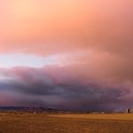
- Red Flag Warnings remain in effect as extreme heat, single-digit humidity, and wind gusts fuel rapid fire growth.
- Mandatory evacuations are underway in Arizona, New Mexico, and Utah as firefighting resources remain stretched.
- The National Preparedness Level has been elevated to 3 due to the widespread fire activity across the West.
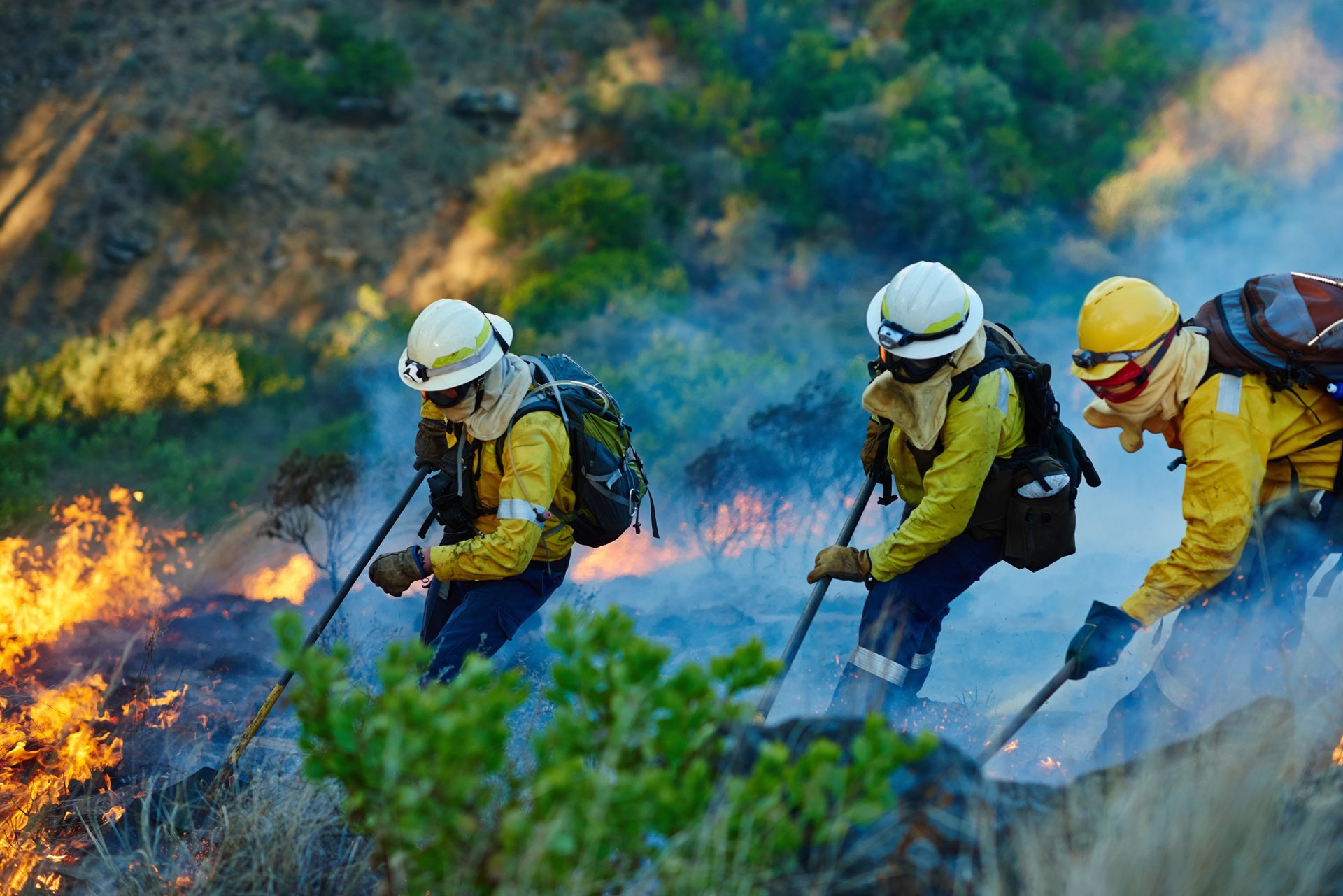
Saturday, June 26, 2026 — As of this morning, fire agencies across the Colorado River Basin are managing multiple significant wildfires amidst widespread critical fire weather. A persistent pattern of extreme heat, low humidity, and powerful winds has triggered numerous Red Flag Warnings, leading to rapid fire growth and challenging suppression efforts [2]. The National Preparedness Level has been elevated to 3, reflecting the increasing commitment of national resources [1].
Utah is currently experiencing the most significant fire activity in the region, with over 160,000 acres burning, dominated by the large Cottonwood, Iron, and Cherry fires [3]. Arizona and Nevada are also battling large, complex incidents, including the Sycamore Fire in Arizona and the Grapevine Fire in Nevada [3]. Mandatory evacuation orders are in effect for communities in Arizona, New Mexico, and Utah [5,14,16].
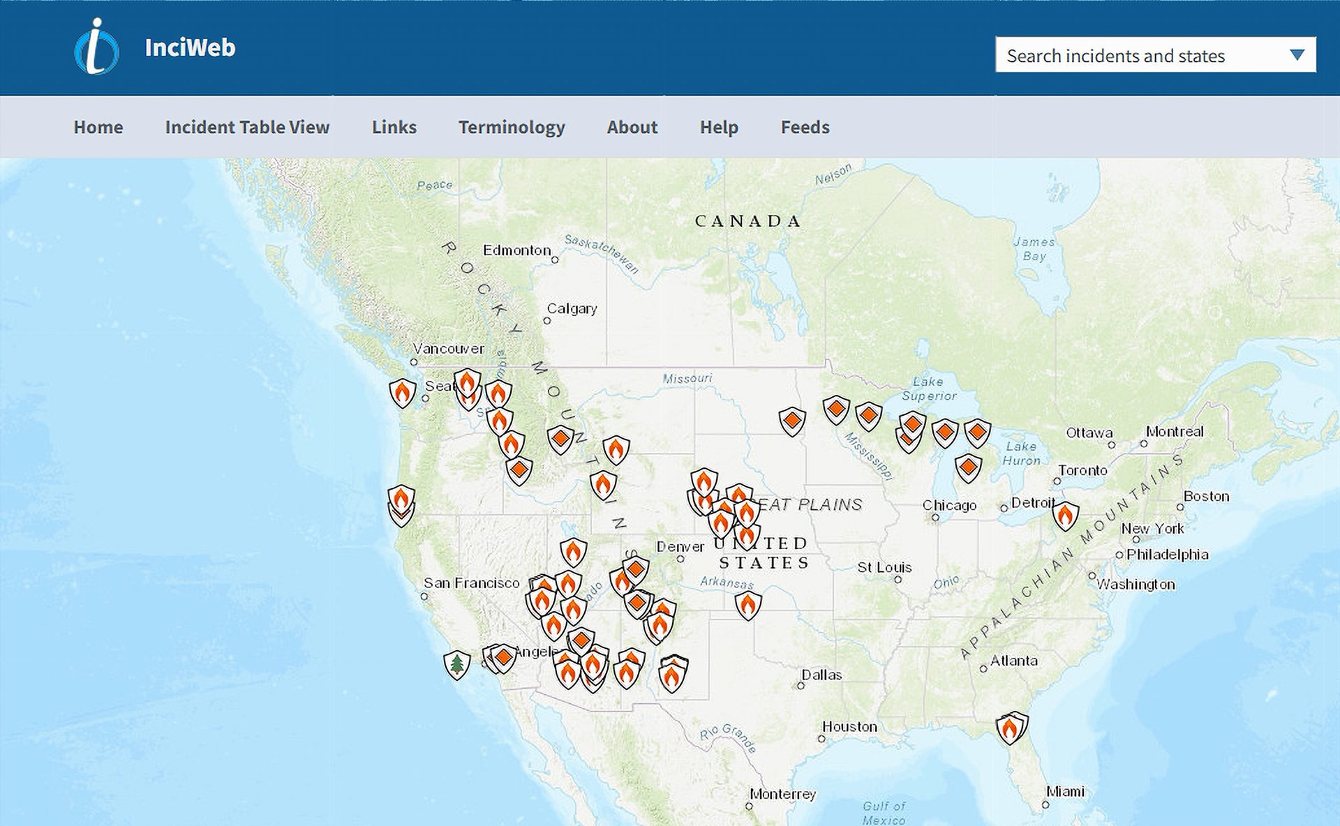
This report provides a detailed, state-by-state assessment of all major active wildfires as of this date, compiling data from official sources to deliver a comprehensive situational overview for the Colorado River Basin.
| State | Total Active Acres Burning [3] | Major Active Incidents |
|---|---|---|
| Utah | 163,884 acres | Cottonwood Fire, Iron Fire, Cherry Fire |
| Nevada | 41,489 acres | Grapevine Fire, Kane Springs Fire |
| Arizona | 18,925 acres | Sycamore Fire, Rock Canyon Fire, Pocket Fire |
| New Mexico | 1,804 acres | Canyon Venado Fire, McCauley Springs Fire, Rio Fire |
| Wyoming | 890 acres | Kinky Creek Fire |
| California* | 478 acres | Rocky Fire, Sandy Fire, Pond Fire |
| Colorado | 316 acres | Dry Creek Fire |
| Total | 227,786 acres |
*Note: Figures for California represent all reported active fires; not all are confirmed to be within the Colorado River Basin watershed.
Methodology
This report was compiled on June 27, 2026, to provide a timely snapshot of wildfire activity. Information was gathered exclusively from official and verified sources, including the National Interagency Fire Center (NIFC), the interagency InciWeb incident information system, state-level fire management agencies (e.g., CAL FIRE, NM Fire Info), and local emergency management offices [19,20,21]. Research focused on incident reports, situation updates, and weather advisories published on or immediately preceding June 27, 2026. The primary limitation is the dynamic nature of wildfire incidents; data such as acreage and containment can change rapidly. All sources are cited to allow for independent verification.
Arizona.
Arizona is experiencing significant wildfire activity driven by extremely critical fire weather. Red Flag Warnings are in effect for much of the state, with powerful winds and single-digit humidity contributing to rapid fire spread. Stage 2 fire restrictions are widespread across national forests and state lands [4,7].
Total Acres Currently Burning in Arizona: 18,925 acres [3]
Active Wildfires in Arizona.
Sycamore Fire.
- Location: 15 miles north of Globe, Tonto National Forest
- Start Date: Not specified in recent reports; active in late June 2026
- Cause/Origin: Lightning
- Current Acreage: 11,852 acres
- Containment: 37% [2]
- Evacuation Status: No explicit evacuation orders have been reported, but the fire poses a threat to local structures and energy infrastructure [2].
- Weather Outlook: The fire is within an area under a Red Flag Warning, with strong winds and very low humidity expected to continue, challenging containment efforts [4,6].
- Personnel & Structures: Details on personnel are not available. The fire threatens energy infrastructure and local structures.
Rock Canyon Fire.
- Location: Bureau of Land Management and Kaibab National Forest lands
- Start Date: Not specified in recent reports; active in late June 2026
- Cause/Origin: Not specified
- Current Acreage: 4,823 acres
- Containment: 90% [3,4]
- Evacuation Status: No active evacuations. Crews are transitioning to suppression repair work [4].
- Weather Outlook: General state weather conditions of high wind and low humidity apply, but high containment minimizes the threat of spread.
- Personnel & Structures: No specific numbers available.
Pocket Fire.
- Location: 7 miles north of Sedona, Coconino National Forest
- Start Date: Not specified in recent reports; active in late June 2026
- Cause/Origin: Not specified
- Current Acreage: 2,114 acres
- Containment: 0% [5]
- Evacuation Status: Mandatory “GO” evacuation orders were issued for Oak Creek Canyon (Zones 14 and 15), with some areas later downgraded to “SET” (Be Prepared) [5,6].
- Weather Outlook: A Red Flag Warning is in effect, with southwest wind gusts up to 50 mph and extremely low humidity (5-15%). These conditions are conducive to extreme fire behavior and rapid spread in the steep, inaccessible terrain [5].
- Personnel & Structures: Personnel numbers not specified. State Route 89A is closed between Sedona and Flagstaff. The fire is burning in an area with residential structures [5,6].
Flat Fire.
- Location: 9 miles southwest of Heber, Apache-Sitgreaves National Forest
- Start Date: Not specified in recent reports; active in late June 2026
- Cause/Origin: Not specified
- Current Acreage: 136 acres
- Containment: 66% [2]
- Evacuation Status: No active evacuations reported.
- Weather Outlook: While smaller, the fire is subject to the same regional Red Flag conditions.
- Personnel & Structures: No specific numbers available.
California.
California has seen an active start to its fire season, with 2,584 wildfires burning 79,691 acres year-to-date within CAL FIRE jurisdiction [9]. The fires listed below are currently active, though not all are geographically located within the Colorado River Basin watershed. Southern California remains warmer and drier than normal [8].
Total Acres Currently Burning in California: 478 acres [8]
Active Wildfires in California.
Rocky Fire.
- Location: Modoc County
- Start Date: June 23, 2026
- Cause/Origin: Not specified
- Current Acreage: 298 acres
- Containment: 50% [8]
- Evacuation Status: No active evacuations reported.
- Weather Outlook: Northern California is experiencing a steady drying trend, increasing fire potential [8].
- Personnel & Structures: Details not available.
Sandy Fire.
- Location: Kern County
- Start Date: June 21, 2026
- Cause/Origin: Not specified
- Current Acreage: 99 acres
- Containment: 80% [8]
- Evacuation Status: No active evacuations reported.
- Weather Outlook: Southern California is forecast to remain warmer and drier than normal [8].
- Personnel & Structures: Details not available.
Pond Fire.
- Location: Kern County
- Start Date: June 26, 2026
- Cause/Origin: Not specified
- Current Acreage: 50 acres
- Containment: 0% [8]
- Evacuation Status: No active evacuations reported.
- Weather Outlook: Subject to warm and dry conditions typical for the area.
- Personnel & Structures: Details not available.
Pentz Fire.
- Location: Butte County
- Start Date: June 26, 2026
- Cause/Origin: Not specified
- Current Acreage: 31 acres
- Containment: 85% [8]
- Evacuation Status: No active evacuations reported.
- Weather Outlook: Located in Northern California, which has increasing fire potential due to drying fuels [8].
- Personnel & Structures: Details not available.
Colorado.
Colorado’s Western Slope experienced a period of elevated fire activity in June, driven by high temperatures, low humidity, and gusty winds [10]. While several fires have been contained, one incident remains active. The State Emergency Operations Center is activated to monitor the situation [12].
Total Acres Currently Burning in Colorado: 316 acres [10]
Active Wildfires in Colorado.
Dry Creek Fire.
- Location: 3 miles south of Rifle, Garfield County
- Start Date: June 23, 2026
- Cause/Origin: Not specified
- Current Acreage: 316 acres
- Containment: 90% [11]
- Evacuation Status: Evacuation orders for the Grass Mesa area were lifted, but the area remains in a pre-evacuation “SET” status [11].
- Weather Outlook: The region has faced Red Flag Warnings with low relative humidity (5-10%) and gusty winds, though moderating conditions and high containment have lessened the threat [10].
- Personnel & Structures: The incident has been transitioned back to local agency control. The fire burned in a wildland-urban interface, but no structures damaged have been reported [11].
New Mexico.
New Mexico is battling several active fires, particularly in the northern part of the state. A Complex Incident Management Team has been assigned to the most significant new start, the McCauley Springs Fire [14]. Critical fire weather with gusty winds from scattered dry thunderstorms poses a risk for new ignitions and rapid growth of existing fires [2].
Total Acres Currently Burning in New Mexico: 1,804 acres [3]
Active Wildfires in New Mexico.
Canyon Venado Fire.
- Location: East of Clines Corners, Torrance County
- Start Date: June 23, 2026
- Cause/Origin: Not specified
- Current Acreage: 908 acres
- Containment: 50% [2]
- Evacuation Status: No active evacuations reported.
- Weather Outlook: Regional critical fire weather warnings are in effect, with a high potential for gusty outflow winds.
- Personnel & Structures: Details not available. A wind farm and other nearby structures are threatened [13].
McCauley Springs Fire.
- Location: Jemez Ranger District, Santa Fe National Forest
- Start Date: June 24, 2026
- Cause/Origin: Not specified
- Current Acreage: 722 acres
- Containment: 0% [14]
- Evacuation Status: Mandatory “GO” evacuation orders are in effect for the community of Sierra de los Pinos and the Jemez Falls Campground [14,15].
- Weather Outlook: Hot, dry, and windy conditions persist. Wind gusts may reach 35-55 mph with very low humidity, creating conditions prone to rapid fire spread [2].
- Personnel & Structures: The Southwest Complex Incident Management Team 3 has assumed command. Electrical shutoffs are active in the area. Highway 4 is closed [14,15].
Rio Fire.
- Location: Espanola Ranger District, Santa Fe National Forest
- Start Date: Not specified in recent reports; active in late June 2026
- Cause/Origin: Not specified
- Current Acreage: 167 acres
- Containment: 75% [1,3]
- Evacuation Status: No active evacuations reported.
- Weather Outlook: General statewide critical fire conditions apply.
- Personnel & Structures: Details not available.
Beehive Fire.
- Location: Tres Piedras Ranger District
- Start Date: June 26, 2026 (New Start)
- Cause/Origin: Not specified
- Current Acreage: 4 acres
- Containment: Not specified [13]
- Evacuation Status: No active evacuations reported.
- Weather Outlook: Subject to regional critical fire weather.
- Personnel & Structures: Details not available.
Note: The Sacaton, Foster, and Rose fires are also active new starts, but official acreage figures have not yet been released. [13]
Nevada.
Nevada is contending with significant wildfire activity, primarily concentrated in the eastern part of the state. Fire managers are responding to several large fires burning in grass and brush under challenging wind conditions [3].
Total Acres Currently Burning in Nevada: 41,489 acres [3]
Active Wildfires in Nevada.
Grapevine Fire.
- Location: Lincoln County, managed by Ely District BLM (NVELD)
- Start Date: Not specified in recent reports; active on June 27, 2026
- Cause/Origin: Not specified
- Current Acreage: 24,047 acres
- Containment: Not specified [3]
- Evacuation Status: No active evacuations reported.
- Weather Outlook: The Great Basin is under “extremely critical” fire weather warnings with southwesterly wind gusts of 30-50 mph and very low humidity [2,18].
- Personnel & Structures: Details not available.
Kane Springs Fire.
- Location: 17 miles southwest of Caliente, Lincoln County (NVELD)
- Start Date: Not specified in recent reports; active on June 27, 2026
- Cause/Origin: Not specified
- Current Acreage: 17,042 acres
- Containment: 50% [17]
- Evacuation Status: No active evacuations reported.
- Weather Outlook: Subject to the same critical fire weather affecting the Great Basin.
- Personnel & Structures: Details not available.
Parsnip Peak Fire.
- Location: Lincoln County (NVELD)
- Start Date: Not specified in recent reports; active on June 27, 2026
- Cause/Origin: Not specified
- Current Acreage: 300 acres
- Containment: Not specified [3]
- Evacuation Status: No active evacuations reported.
- Weather Outlook: Subject to regional critical fire weather.
- Personnel & Structures: Details not available.
Dry Canyon Fire.
- Location: Lincoln County (NVELD)
- Start Date: Not specified in recent reports; active on June 27, 2026
- Cause/Origin: Not specified
- Current Acreage: 100 acres
- Containment: Not specified [3]
- Evacuation Status: No active evacuations reported.
- Weather Outlook: Subject to regional critical fire weather.
- Personnel & Structures: Details not available.
Utah.
Utah is currently the epicenter of wildfire activity in the Colorado River Basin, with several very large, wind-driven fires burning across the state [2]. A Great Basin Complex Incident Management Team is managing the largest incidents [16]. Critical fire weather and a strong cold front are expected to influence fire behavior significantly.
Total Acres Currently Burning in Utah: 163,884 acres [3]
Active Wildfires in Utah.
Cottonwood Fire.
- Location: Near Beaver, Utah (Fishlake National Forest)
- Start Date: Not specified in recent reports; active in late June 2026
- Cause/Origin: Not specified
- Current Acreage: 92,254 acres
- Containment: Not specified [3]
- Evacuation Status: No active evacuations reported in recent updates.
- Weather Outlook: Extremely critical fire weather with strong winds and low humidity contributed to explosive growth. Some precipitation moderated behavior slightly, but conditions remain dangerous [2].
- Personnel & Structures: Details not available.
Iron Fire.
- Location: Northwest of Eureka, Juab and Tooele Counties
- Start Date: Not specified in recent reports; active on June 27, 2026
- Cause/Origin: Not specified
- Current Acreage: 40,864 acres
- Containment: 38%
- Evacuation Status: Part of a complex of fires that prompted “GO” evacuations for the Lofgreen area [16].
- Weather Outlook: Area is under a Red Flag Warning. Strong southwest winds with gusts up to 40 mph are expected, followed by a cold front with strong northwest winds later in the evening [16].
- Personnel & Structures: Managed by Great Basin Complex Incident Management Team 3 [16].
Cherry Fire.
- Location: Near Vernon Reservoir, Juab County
- Start Date: June 26, 2026
- Cause/Origin: Lightning
- Current Acreage: 30,766 acres [16]
- Containment: Not specified
- Evacuation Status: Mandatory “GO” evacuation orders are in effect for the area surrounding Vernon Reservoir and Lofgreen. A shelter has been established [16].
- Weather Outlook: The fire is under a Red Flag Warning with strong, gusty winds from the southwest, shifting to the northwest with a frontal passage [16].
- Personnel & Structures: Managed by Great Basin Complex Incident Management Team 3. SR-36 is closed in the area [16].
Note: The Dellenbaugh Fire (779 acres) is also active, but fewer details are available. [3]
Wyoming.
Wyoming’s current fire activity is low compared to other basin states. One active fire is reported in the western part of the state [3].
Total Acres Currently Burning in Wyoming: 890 acres [3]
Active Wildfires in Wyoming.
Kinky Creek Fire.
- Location: Bridger-Teton National Forest (WYBTF)
- Start Date: Not specified in recent reports; active on June 27, 2026
- Cause/Origin: Not specified
- Current Acreage: 890 acres
- Containment: Not specified [3]
- Evacuation Status: No active evacuations reported.
- Weather Outlook: Cooler air is forecast to spread into the northern Intermountain West, which may help moderate fire behavior [1].
- Personnel & Structures: Details not available.
References
1. https://www.nifc.gov/fire-information/nfn
2. https://www.nifc.gov/nicc-files/sitreprt.pdf
3. https://inciweb.wildfire.gov/accessible-view
4. https://fires.cornea.is/state/arizona
5. https://inciweb.wildfire.gov/incident-information/azcof-pocket-fire
6. https://ktar.com/arizona-wildfire-news/pocket-fire-sedona-weather/5881570/
7. https://ein.az.gov/emergency-bulletins-0
8. https://www.fire.ca.gov/incidents
9. https://www.fire.ca.gov/incidents/2026
10. https://fires.cornea.is/state/colorado
11. https://www.garfieldcounty.net/2026/06/
12. https://dhsem.colorado.gov/news-article/seoc-update-june-23-2026
16. https://inciweb.wildfire.gov/incident-information/ututs-iron
17. https://inciweb.wildfire.gov/incident-information/nveld-kane-springs
19. https://inciweb.wildfire.gov/
21. https://www.emnrd.nm.gov/sfd/current-wildfire-information/