Wednesday, July 1, 2026 — The Colorado River Basin stands as the lifeblood of the American Southwest, providing water to approximately 40 million people, irrigating millions of acres of farmland, and generating significant hydroelectric power across seven U.S. states and parts of Mexico [5, 19]. The management of this vital, yet overallocated and arid, watershed hinges on an extensive network of dams and reservoirs. This engineered system, governed by a collection of compacts, laws, and decrees collectively known as the “Law of the River,” was designed to capture the river’s highly variable flows, mitigate floods, and provide a reliable water supply in a region defined by its scarcity [8, 44]. The total storage capacity of the entire basin is estimated to be between 60 and 62 million acre-feet (MAF), roughly four times the river’s average annual flow, with the two largest reservoirs—Lake Powell and Lake Mead—accounting for over 80% of this total [3, 10].
This report provides a comprehensive inventory of the major documented reservoirs within the Colorado River Basin, organized by state. In the context of a historic, multi-decade drought that began in the year 2000 and has been exacerbated by climate change, the status of these reservoirs is a matter of critical regional, national, and international importance [10]. The data presented herein offers a snapshot of reservoir conditions as of June 2026, a period marked by continued stress on the system and intensive negotiations over post-2026 operating guidelines [21]. This document aims to serve as a foundational reference for policymakers, researchers, and the public by detailing the capacity, current storage levels, managing entities, and water sources for each key facility.
Image of the seven Colorado River Basin States via the Arizona Department of Water Resources .
.
Methodology
The information compiled in this report was synthesized from a range of authoritative and credible sources to ensure accuracy and completeness. The research process adhered to a defined hierarchy of sources to resolve data conflicts and prioritize official information. The primary sources were the U.S. Bureau of Reclamation (USBR), the principal managing agency for the basin’s major federal dams, and the U.S. Geological Survey (USGS), which provides foundational scientific data, including bathymetric surveys that refine reservoir capacity estimates [13, 17, 44]. Secondary priority was given to state-level water resource agencies, such as the Colorado Division of Water Resources and the Arizona Department of Water Resources, which often provide aggregated data and information on non-federal reservoirs [1, 7]. Tertiary sources included academic publications and reputable data aggregators that cite official agency data.
A freshness rule was applied to ensure the report reflects the most current conditions possible. The data, particularly current storage levels, were sourced from the latest available reports, dashboards, and operational updates with an observation date on or before the cutoff of June 30, 2026. Data from “real-time” or “daily” dashboards are noted with the specific date of observation [27, 50]. All data, especially current storage figures, should be considered provisional as they are often subject to review and revision by the source agencies. For every reservoir entry, full source URLs are provided to allow for direct verification of the underlying data. Fields for which no credible information could be found within the researched materials are explicitly marked as “Not Available.”
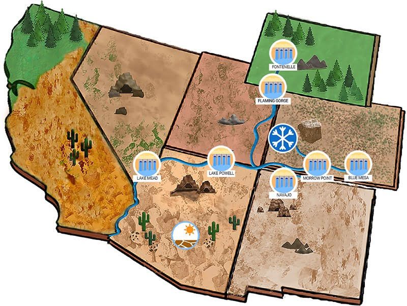
Basin-Wide Overview and Major Reservoir Comparison
The Colorado River reservoir system is facing unprecedented challenges. As of the first half of 2026, total system storage had fallen to approximately 36% of its full capacity [19, 30]. This decline is the result of prolonged drought, low snowpack, and a structural deficit where consumptive use has consistently outpaced the river’s natural flow [4]. In response, the Bureau of Reclamation and basin states have implemented emergency measures under Drought Response Operating Agreements (DROA), including releasing water from upstream reservoirs like Flaming Gorge to bolster the declining levels of Lake Powell and protect its ability to generate power and deliver water downstream [30]. The following table provides a comparative summary of the largest and most critical reservoirs in the basin, illustrating their current status in the context of their vast capacities.
| Reservoir | State(s) | Managing Agency | Total Capacity (acre-feet) | Current Storage (acre-feet) | Percent of Capacity | Observation Date |
|---|---|---|---|---|---|---|
| Lake Mead | AZ, NV | U.S. Bureau of Reclamation | 26,100,000 [20] | 7,680,000 [2] | 29% [2] | May 31, 2026 |
| Lake Powell | AZ, UT | U.S. Bureau of Reclamation | 25,160,000 [13] | 4,770,000 [48] | 19% [48] | May 31, 2026 (Projected) |
| Flaming Gorge Res. | UT, WY | U.S. Bureau of Reclamation | 3,788,900 [31] | 2,707,379 [51] | 77% (of live capacity) [46] | June 3, 2026 |
| Navajo Reservoir | NM, CO | U.S. Bureau of Reclamation | 1,708,600 [37] | 973,902 [50] | 57% [49] | June 29, 2026 |
| Blue Mesa Reservoir | CO | U.S. Bureau of Reclamation | 938,141 [39] | 431,545 [7] | 46% [7] | June 29, 2026 |
Arizona
Arizona is home to some of the most critical infrastructure in the Lower Colorado River Basin. The reservoirs situated along its borders are essential for supplying water to its major metropolitan areas, vast agricultural sector, and neighboring states. Management is dominated by the U.S. Bureau of Reclamation, which operates the large dams that control the river’s flow through the state.
Lake Mead
- Surface Area: Variable; approximately 158,000 acres at full capacity [11].
- Inflow/Source: Primarily fed by the Colorado River, with smaller contributions from the Virgin and Muddy Rivers and the Las Vegas Wash. Its level is directly controlled by releases from Glen Canyon Dam upstream [11].
- Managing Agency: The U.S. Bureau of Reclamation operates Hoover Dam, while the National Park Service manages recreation at the Lake Mead National Recreation Area [11, 25].
- Storage Capacity: Lake Mead is the largest reservoir in the United States by volume [10]. Its total capacity is complex to define, with various figures cited for different purposes. The maximum design capacity at an elevation of 1,221.4 feet is approximately 28.9 MAF [25]. Official figures often cite a capacity of 26.1 MAF, which accounts for dedicated flood control space [20]. The “live capacity” above the minimum power pool elevation is significantly less.
- Current Storage Level: As of May 31, 2026, storage was approximately 7,680,000 acre-feet, which is roughly 29% of its total capacity [2]. (Observation Date: May 31, 2026)
- Sources: [2, 11, 16, 20, 25]
Lake Mohave
- Surface Area: Approximately 28,000 to 30,000 acres at its typical operating elevation of 647 feet [15].
- Inflow/Source: Filled by cold, clear water released from Hoover Dam, located 67 miles upstream [12].
- Managing Agency: U.S. Bureau of Reclamation (operates Davis Dam). The National Park Service manages recreation [12, 36].
- Storage Capacity: Total storage capacity is 1,818,300 acre-feet [15, 36].
- Current Storage Level: As of June 29, 2026, storage was 1,691,600 acre-feet, which is 93% of its total capacity [15, 27]. (Observation Date: June 29, 2026)
- Sources: [12, 15, 27, 36]
Lake Havasu
- Surface Area: Approximately 20,400 acres [53].
- Inflow/Source: Filled by releases from Davis Dam on the Colorado River [26].
- Managing Agency: U.S. Bureau of Reclamation (operates Parker Dam) [26, 33].
- Storage Capacity: Total capacity is approximately 646,200 acre-feet. Some sources cite up to 648,000 acre-feet [33, 53]. It serves as the primary diversion point for both the Central Arizona Project (CAP) and the Metropolitan Water District of Southern California’s Colorado River Aqueduct.
- Current Storage Level: As of June 29, 2026, storage was 610,900 acre-feet, which is 95% of its total capacity [14, 27]. (Observation Date: June 29, 2026)
- Sources: [14, 26, 27, 33, 53]
California
California’s access to the Colorado River is primarily through diversions rather than in-state storage reservoirs within the basin. Its rights are among the most senior on the river. The state shares one major reservoir on its border.
Lake Havasu
- Surface Area: Approximately 20,400 acres [53].
- Inflow/Source: Filled by releases from Davis Dam on the Colorado River. Lake Havasu is formed by Parker Dam, which spans the border between California and Arizona [26].
- Managing Agency: U.S. Bureau of Reclamation [26, 33].
- Storage Capacity: Total capacity is approximately 646,200 acre-feet. The reservoir is a critical forebay for the Colorado River Aqueduct, which supplies water to Southern California [33, 53].
- Current Storage Level: As of June 29, 2026, storage was 610,900 acre-feet, which is 95% of its total capacity [27]. (Observation Date: June 29, 2026)
- Sources: [26, 27, 33, 53]
Colorado
As a headwaters state, Colorado is the source of much of the water that flows into the Colorado River system. The state contains numerous reservoirs that are integral to both local water supply and meeting its downstream delivery obligations under the Colorado River Compact.
Blue Mesa Reservoir
- Surface Area: 9,219 acres at maximum water surface elevation (7,519.4 feet) [39].
- Inflow/Source: Gunnison River [38].
- Managing Agency: U.S. Bureau of Reclamation. It is the largest reservoir in the Aspinall Unit [38].
- Storage Capacity: A 2019 USBR sedimentation survey established the total capacity as 938,141 acre-feet [39]. Older documents may cite the original design capacity of 940,700 acre-feet. Active capacity is 748,430 acre-feet [38].
- Current Storage Level: As of June 29, 2026, storage was 431,545 acre-feet, which is 46% of its new total capacity [7]. (Observation Date: June 29, 2026)
- Sources: [6, 7, 38, 39]
Morrow Point Reservoir
- Surface Area: 817 acres [37].
- Inflow/Source: Filled by releases from Blue Mesa Dam on the Gunnison River [37].
- Managing Agency: U.S. Bureau of Reclamation. It is the second reservoir in the Aspinall Unit [37].
- Storage Capacity: Total capacity of 117,190 acre-feet [37].
- Current Storage Level: As of June 29, 2026, storage was 114,834 acre-feet, which is 98% of its total capacity [1, 7]. (Observation Date: June 29, 2026)
- Sources: [1, 7, 37]
Crystal Reservoir
- Surface Area: Not Available from provided sources.
- Inflow/Source: Filled by releases from Morrow Point Dam on the Gunnison River [37].
- Managing Agency: U.S. Bureau of Reclamation. It is the third and final reservoir in the Aspinall Unit [37].
- Storage Capacity: Total capacity of 25,520 acre-feet [37].
- Current Storage Level: As of June 29, 2026, storage was 15,362 acre-feet, which is 60% of its total capacity [7]. (Observation Date: June 29, 2026)
- Sources: [7, 37]
Dillon Reservoir
- Surface Area: Not Available from provided sources.
- Inflow/Source: Blue River [28].
- Managing Agency: Denver Water. It is not a USBR facility, which is why detailed specifications are not present in federal databases [28].
- Storage Capacity: Not Available from provided sources.
- Current Storage Level: As of June 29, 2026, storage was 250,917 acre-feet [7]. Percent of capacity is not available as total capacity is not documented in the provided sources. (Observation Date: June 29, 2026)
- Sources: [7, 28]
Lake Granby
- Surface Area: Approximately 7,250 acres [23].
- Inflow/Source: Primarily filled by the Colorado River, with supplemental water pumped from Willow Creek Reservoir. It is a key storage component of the Colorado-Big Thompson Project [35].
- Managing Agency: Operated by the Northern Colorado Water Conservancy District in coordination with the U.S. Bureau of Reclamation [35].
- Storage Capacity: Total storage capacity is 539,800 acre-feet [35].
- Current Storage Level: As of June 29, 2026, storage was 473,078 acre-feet, which is 88% of its total capacity [6, 7]. (Observation Date: June 29, 2026)
- Sources: [6, 7, 23, 35]
Green Mountain Reservoir
- Surface Area: Approximately 2,125 acres [24].
- Inflow/Source: Blue River [29].
- Managing Agency: U.S. Bureau of Reclamation. It is a feature of the Colorado-Big Thompson Project [29].
- Storage Capacity: While often cited as storing “more than 150,000 acre-feet,” its formal total capacity is 154,644 acre-feet. This includes a 66,000 acre-foot “Historic User Pool” for West Slope beneficiaries [29].
- Current Storage Level: As of June 29, 2026, storage was 142,654 acre-feet, which is 92% of its total capacity [6, 7]. (Observation Date: June 29, 2026)
- Sources: [6, 7, 24, 29]
Groundhog Reservoir
- Surface Area: 734 acres at spillway elevation [17].
- Inflow/Source: Groundhog Creek [17].
- Managing Agency: Dolores Water Conservancy District [17].
- Storage Capacity: 25,700 acre-feet, as determined by a 2011 USGS bathymetric survey [17].
- Current Storage Level: Not Available from provided sources.
- Sources: [17]
Totten Reservoir
- Surface Area: 244 acres at spillway elevation [17].
- Inflow/Source: Not Available from provided sources.
- Managing Agency: Dolores Water Conservancy District [17].
- Storage Capacity: 2,990 acre-feet, as determined by a 2011 USGS bathymetric survey [17].
- Current Storage Level: Not Available from provided sources.
- Sources: [17]
Wolford Mountain Reservoir
- Surface Area: Not Available from provided sources.
- Inflow/Source: Muddy Creek [22].
- Managing Agency: Colorado River Water Conservation District [22].
- Storage Capacity: Not Available from provided sources.
- Current Storage Level: As of June 29, 2026, storage was 60,670 acre-feet [7]. Percent of capacity is not available as total capacity is not documented in the provided sources. (Observation Date: June 29, 2026)
- Sources: [7, 22]
Nevada
Nevada is the driest state in the nation and relies heavily on its allocation from the Colorado River. It shares two major reservoirs on its border with Arizona, which are fundamental to the water supply of the Las Vegas metropolitan area.
Lake Mead
- Surface Area: Variable; approximately 158,000 acres at full capacity [11].
- Inflow/Source: Primarily fed by the Colorado River. The reservoir is formed by Hoover Dam, which spans the border between Nevada and Arizona [10].
- Managing Agency: U.S. Bureau of Reclamation [25].
- Storage Capacity: Total capacity of approximately 26.1 MAF [25]. It serves as the primary water storage facility for the Lower Basin, including Southern Nevada.
- Current Storage Level: As of May 31, 2026, storage was approximately 7,680,000 acre-feet, which is roughly 29% of its total capacity [16]. (Observation Date: May 31, 2026)
- Sources: [10, 16, 25]
Lake Mohave
- Surface Area: Approximately 28,000 to 30,000 acres [15].
- Inflow/Source: Filled by releases from Hoover Dam on the Colorado River. The reservoir is formed by Davis Dam, downstream of Hoover Dam [36].
- Managing Agency: U.S. Bureau of Reclamation [36].
- Storage Capacity: Total storage capacity is 1,818,300 acre-feet [15, 36].
- Current Storage Level: As of June 29, 2026, storage was 1,691,600 acre-feet, which is 93% of its total capacity [15, 27]. (Observation Date: June 29, 2026)
- Sources: [15, 27, 36]
New Mexico
New Mexico’s portion of the Colorado River Basin is centered on the San Juan River, a major tributary. The state operates a key storage facility as part of the Colorado River Storage Project and several other reservoirs integral to local and tribal water supply.
Navajo Reservoir
- Surface Area: 15,610 acres when filled [37].
- Inflow/Source: San Juan River [45].
- Managing Agency: U.S. Bureau of Reclamation. It is one of the four original units of the Colorado River Storage Project (CRSP) [37, 45].
- Storage Capacity: Total capacity is 1,708,600 acre-feet, with an active capacity of 1,036,100 acre-feet [37, 45].
- Current Storage Level: As of June 29, 2026, storage was 973,902 acre-feet, which is 57% of its total capacity [49, 50]. (Observation Date: June 29, 2026)
- Sources: [37, 45, 49, 50]
Heron Reservoir
- Surface Area: Not Available from provided sources.
- Inflow/Source: Filled with transbasin water diverted from the San Juan River Basin (a tributary of the Colorado River) as part of the San Juan-Chama Project. This water is stored for use in the Rio Grande Basin [32, 41].
- Managing Agency: U.S. Bureau of Reclamation [32, 41].
- Storage Capacity: Total Capacity of 401,000 acre-feet [32].
- Current Storage Level: As of June 29, 2026, storage was 49,026 acre-feet, which is 12% of its total capacity [40, 50]. (Observation Date: June 29, 2026)
- Sources: [32, 40, 41, 50]
Utah
Utah lies at the heart of the Upper Colorado River Basin, sharing both Lake Powell and Flaming Gorge Reservoir on its borders. The state’s water management is deeply intertwined with the Colorado River Storage Project.
Lake Powell
- Surface Area: Highly variable. At normal water surface elevation, it spans approximately 161,390 acres [43].
- Inflow/Source: Colorado River. It is also fed by the San Juan, Escalante, and Dirty Devil Rivers [43].
- Managing Agency: U.S. Bureau of Reclamation. Glen Canyon Dam, which forms Lake Powell, is the key feature of the Colorado River Storage Project (CRSP) [43].
- Storage Capacity: The capacity has been adjusted due to decades of sedimentation. A 2017-2018 USGS topobathymetric study established the capacity at full pool (elevation 3,702.91 ft) as 25,160,000 acre-feet, a 6.79% decrease from its original 1963 capacity [13, 18]. Some USBR documents may still refer to a capacity of approximately 25 MAF.
- Current Storage Level: The May 2026 USBR 24-Month Study projected the reservoir would have approximately 4,770,000 acre-feet in storage by the end of the water year, which is about 19% of its updated capacity [48]. (Observation Date: May 31, 2026, projection).
- Sources: [13, 18, 43, 48, 52]
Flaming Gorge Reservoir
- Surface Area: 42,020 acres at normal water surface elevation (6,040 feet) [31, 42].
- Inflow/Source: Green River, a major tributary of the Colorado River [42].
- Managing Agency: U.S. Bureau of Reclamation. It is one of the four original CRSP units [31, 42].
- Storage Capacity: Total capacity of 3,788,900 acre-feet, with an active capacity of 3,515,700 acre-feet [31, 42].
- Current Storage Level: As of June 3, 2026, the reservoir held 2,707,379 acre-feet, which represents 77% of its live storage capacity [46, 51]. The reservoir’s level has been lowered as part of drought response operations to send water to Lake Powell [30, 46]. (Observation Date: June 3, 2026)
- Sources: [31, 42, 46, 51]
Wyoming
Wyoming contains the headwaters of the Green River, the Colorado River’s largest tributary. The state’s water use in this basin is governed by the Upper Colorado River Basin Compact. It hosts reservoirs that are part of, or participants in, the Colorado River Storage Project.
Flaming Gorge Reservoir
- Surface Area: 42,020 acres. The reservoir straddles the Utah-Wyoming border [42].
- Inflow/Source: Green River [42].
- Managing Agency: U.S. Bureau of Reclamation [42].
- Storage Capacity: Total capacity of 3,788,900 acre-feet [46].
- Current Storage Level: As of June 3, 2026, the reservoir held 2,707,379 acre-feet, representing 77% of its live capacity [46]. (Observation Date: June 3, 2026)
- Sources: [2, 42, 46]
Fontenelle Reservoir
- Surface Area: Not Available from provided sources.
- Inflow/Source: Green River. It is located upstream of Flaming Gorge [34].
- Managing Agency: U.S. Bureau of Reclamation. It is the main feature of the Seedskadee Project, a participating project of the CRSP [34].
- Storage Capacity: Total capacity is 345,360 acre-feet [34, 47].
- Current Storage Level: As of June 3, 2026, the reservoir held 193,401 acre-feet, which represents 56% of its live capacity [47]. (Observation Date: June 3, 2026)
- Sources: [2, 34, 47]
Big Sandy Reservoir
- Surface Area: Not Available from provided sources.
- Inflow/Source: Big Sandy Creek, a tributary of the Green River [9].
- Managing Agency: U.S. Bureau of Reclamation [9].
- Storage Capacity: 39,700 acre-feet [9].
- Current Storage Level: Not Available from provided sources.
- Sources: [9]
References
- https://www.azwater.gov/crm/dashboard

- https://www.azwater.gov/lake-mead
- https://coloradoriverscience.org/Dams,_reservoirs,_and_other_infrastructure
- https://www.colorado.edu/center/gwc/media/670
- https://www.congress.gov/crs-product/R45546
- https://www.drought.gov/sites/default/files/hero/tool/dmt-thumbnail-usbr-reservoir-storage.jpg
- https://dwr.state.co.us/tools/stations
- https://en.wikipedia.org/wiki/Colorado_River_Storage_Project
- http://library.wrds.uwyo.edu/wrp/93-12/93-12.html
- https://labs.waterdata.usgs.gov/visualizations/OWDI-drought/en/index.html
- https://www.nps.gov/lake/learn/understanding-the-lakes.htm
- https://www.nps.gov/lake/planyourvisit/lake-mohave.htm
- https://pubs.usgs.gov/publication/sir20225017
- https://snoflo.org/reservoir/arizona/lake-havasu
- https://snoflo.org/reservoir/arizona/lake-mohave
- https://snoflo.org/reservoir/nevada/lake-mead
- https://usgs.gov/centers/co-water/science/bathymetry-groundhog-and-totten-reservoirs
- https://www.usgs.gov/centers/utah-water-science-center/science/colorado-river-basin-studies
- https://www.usbr.gov/ColoradoRiverBasin/
- https://www.usbr.gov/ColoradoRiverBasin/post2026/draft-eis/docs/vol-1/P26-DEIS-1-Ch1.pdf
- https://www.usbr.gov/ColoradoRiverBasin/post2026/index.html
- https://www.usbr.gov/gp/ecao/nepa/green_mountain_summit_fonsi.pdf
- https://www.usbr.gov/gp/recreation/granrec.html
- https://www.usbr.gov/gp/recreation/grerrec.html
- https://www.usbr.gov/lc/hooverdam/faqs/lakefaqs.html
- https://www.usbr.gov/lc/hooverdam/parkerdam.html
- https://www.usbr.gov/lc/region/g4000/hourly/levels.html
- https://www.usbr.gov/newsroom/news-release/4704
- https://www.usbr.gov/newsroom/news-release/4833
- https://www.usbr.gov/newsroom/news-release/5326
- https://www.usbr.gov/projects/index.php?id=105
- https://www.usbr.gov/projects/index.php?id=118
- https://www.usbr.gov/projects/index.php?id=207
- https://www.usbr.gov/projects/index.php?id=288
- https://www.usbr.gov/projects/index.php?id=291
- https://www.usbr.gov/projects/index.php?id=47
- https://www.usbr.gov/projects/index.php?id=440
- https://www.usbr.gov/projects/index.php?id=62
- https://www.usbr.gov/tsc/techreferences/reservoir/BlueMesaReservoir2019SedimentationSurvey_Final508.pdf
- https://www.usbr.gov/uc/albuq/water/index.html
- https://www.usbr.gov/uc/albuq/water/SanJuanChama/Reservoirs/heron_indx.html
- https://www.usbr.gov/uc/rm/crsp/fg/
- https://www.usbr.gov/uc/rm/crsp/gc/
- https://www.usbr.gov/uc/rm/crsp/index.html
- https://www.usbr.gov/uc/rm/crsp/navajo/index.html
- https://usbr.gov/uc/water/crsp/cs/fgd.html
- https://usbr.gov/uc/water/crsp/cs/ftd.html
- https://www.usbr.gov/uc/water/crsp/cs/gcd.html
- https://www.usbr.gov/uc/water/crsp/cs/nvd.html
- https://www.usbr.gov/uc/water/hydrodata/
- https://www.usbr.gov/uc/water/hydrodata/reservoir_data/917/dashboard.html
- https://usbr.gov/uc/water/hydrodata/reservoir_data/919/dashboard.html
- https://www.watereducation.org/aquapedia-background/lake-havasu-parker-dam