- Satellite readings show the Sacramento Valley aquifer switched from bouncing back to lasting damage in 2021.
- The shift landed during California’s harsh 2020 to 2022 drought.
- A few spots sank as fast as 50 centimeters, close to 20 inches, in a single year.
- Groundwater levels measured in wells gave no clear warning that the change was coming.
- The valley lost underground storage room each year equal to about 30 percent of Los Angeles’ yearly water use.
Monday, August 3, 2026 — A large part of California’s Sacramento Valley quietly crossed a line in 2021 that it cannot step back over. That is the central finding of a study published July 27, 2026, in the Proceedings of the National Academy of Sciences , a leading peer-reviewed science journal. A team led by researcher Stacy Larochelle used satellites and thousands of well measurements to watch the ground itself, and what they saw was a farming region sinking into permanent harm.
The Difference Between a Sponge and a Crushed Box.
To follow the story, it helps to picture two ways the ground can react when water is pumped out from below.
When an aquifer behaves like a sponge, it squeezes down a little as water leaves and puffs back up when rain and snowmelt refill it. Scientists call this reversible, or poroelastic, deformation. Nothing is lost. The land drops in summer and rises again in winter, year after year.
The other way is more like stepping on a cardboard box. Once it collapses, it stays flat. When the fine clay layers deep in an aquifer are pushed past their limit, they pack down for good. That is called irreversible, or inelastic, compaction. The land drops and stays down, and the underground space that once held water is gone.
The study found that from 2016 to 2020, a stretch between two droughts, the Sacramento Valley mostly acted like the sponge. Then, in 2021, large areas started acting like the crushed box.
Reading the Ground From Space.
Rather than rely on wells alone, the researchers combined several tools. They used a satellite radar method, known as Interferometric Synthetic Aperture Radar, that can measure tiny up-and-down changes in the land surface with millimeter accuracy over wide areas. They paired that with Global Positioning System stations on the ground and with a pair of satellites called the Gravity Recovery and Climate Experiment, which can sense large changes in the total amount of water stored in a region. They also pulled in records from roughly 2,500 groundwater wells.
Together, these tools gave a detailed picture from 2016 through 2022. During the calm years, the land rose and fell with the seasons, matching the pumping in summer and the recharge in winter. Starting in 2021, that pattern broke. Broad areas kept sinking and did not bounce back, even when winter rains returned at the end of the year.
In the hardest-hit spots, the ground dropped as much as 50 centimeters in a year. The authors note that this pace is similar to what has been recorded in the neighboring San Joaquin Valley, a region long known for severe, permanent sinking.
The Warning Signs Wells Missed.
One of the study’s more surprising points is that the usual way of tracking trouble, watching water levels in wells, did not see this coming.
A well only measures water pressure in the narrow slice of ground where it is screened. The deep clay layers that were compacting were often not the layers the wells were reading. The result was a strange mismatch. Among wells that hit a new record low in 2021 and 2022, about 70 percent showed no serious sinking above the ground. Meanwhile, more than half of the wells that did not hit a new low sat over land that was sinking fast.
The authors conclude that the shift “could not have been anticipated from the available groundwater records alone.” In plain terms, the standard early-warning system was blind to the damage until the satellites revealed it.
What Was Lost, and Whether It Comes Back.
The permanent sinking carries a permanent cost. When clay compacts, the pore space that once held water is crushed out, so the aquifer can never store as much again.
The researchers estimate the valley lost storage room at a rate of about 0.2 cubic kilometers per year during the drought. That is a fivefold jump from the 0.04 cubic kilometers per year seen in the earlier calm period. To put that yearly loss in familiar terms, the study compares it to 4 percent of Shasta Lake, California’s largest reservoir, or roughly 30 percent of the water Los Angeles uses in a year.
The authors are direct about the finality of it. As they write, “this compaction will never recover.”
There is a note of cautious hope. A recent surge in precipitation across California raises the chance that the aquifer may return to the sponge-like, reversible behavior as pumping eases and recharge picks up. Even so, the team expects some thick, slow-draining clay layers to keep settling for years to come, meaning the drought’s effects on the land may linger well past the drought itself.
Why It Matters Beyond One Valley.
The Sacramento Valley makes up the northern third of California’s Central Valley, a region that grows roughly a quarter of the nation’s food, including water-hungry crops such as rice, fruits, and nuts. Notably, when California passed its Sustainable Groundwater Management Act in 2014, state officials labeled many San Joaquin Valley areas as critically overdrafted but placed no such label on the Sacramento Valley.
The new findings suggest that gap deserves a second look. The authors argue their results “may warrant the critically overdrafted designation and underscore the urgent need for more conservative groundwater management practices.”
More broadly, the study makes the case that satellites watching the land surface can catch this kind of hidden damage early, in places where ground wells cannot, offering a tool that could protect groundwater in stressed regions around the world.
Citation.
Larochelle, S., Chanard, K., Dalaison, M., Fortin, J., Jolivet, R., Longuevergne, L., Fleitout, L., Argus, D. F., Gauer, L.-M., & Avouac, J.-P. (2026). Abrupt transition to irreversible damage in the overdrafted Sacramento Valley aquifer system. Proceedings of the National Academy of Sciences, 123(31), e2526041123. https://doi.org/10.1073/pnas.2526041123
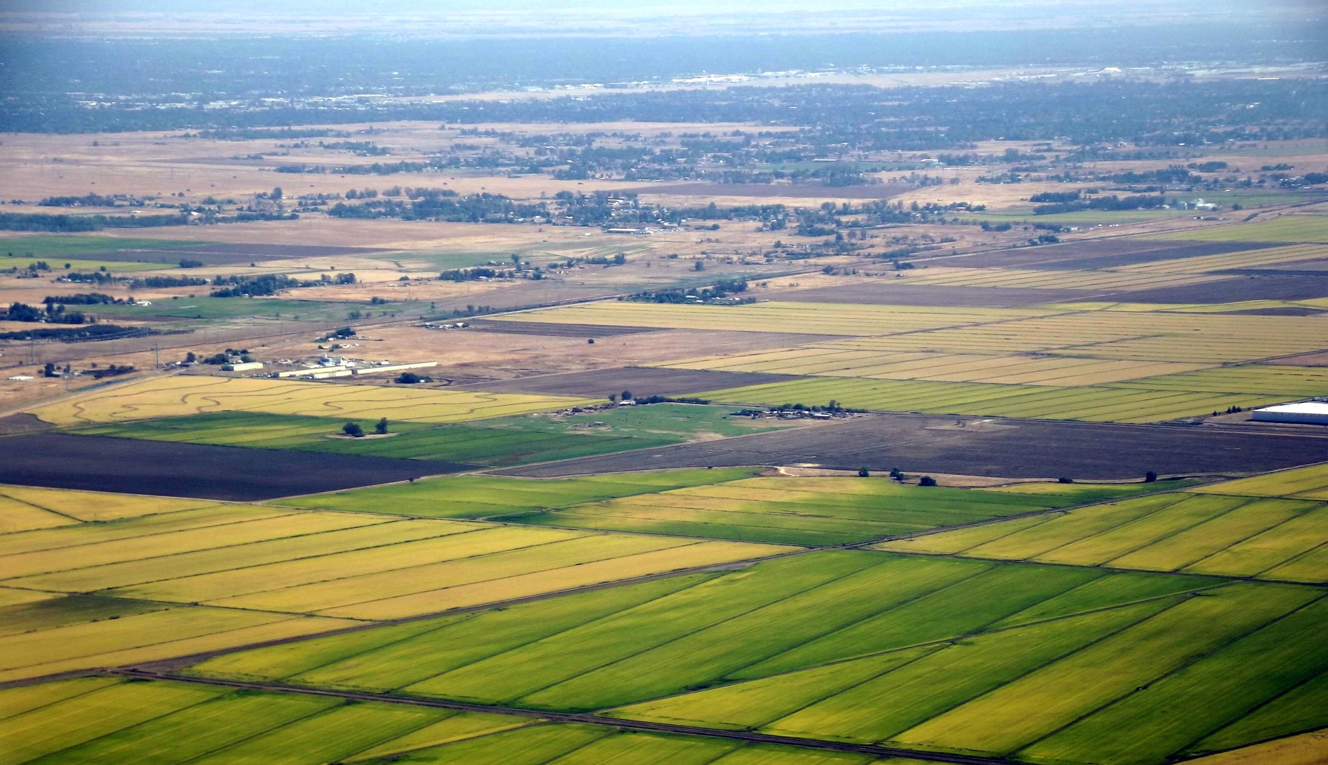
Pictured: Rice fields north of the City of Sacramento , by Mark Miller, September 2014. Licensed under the Creative Commons Attribution 3.0 Unported license.