
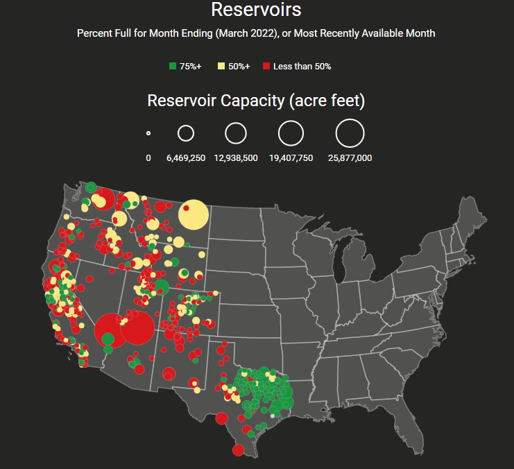
News about the water levels at Lake Powell and Lake Mead, both critical reservoirs serving the Colorado River Compact states, is plentiful. But there are many other reservoirs that are important for water management in these states.
Dean Farrell , a developer for the University of North Carolina Libraries, has created a visual tool tracking the reservoir capacities for dozens of storage facilities throughout the western states and Texas. The interactive map starts with the year 2000 and continues to the present. State specific data is also available for the Lower Colorado Basin states (Arizona, California, and Nevada) and the Upper Colorado Basin States (Colorado, New Mexico, Utah, and Wyoming).
While Farrell notes some limitations in data, the interactive maps are a great visual for storage capacity conditions in the western states.
Image Source:
Screen shot from DeanFarr.com.