
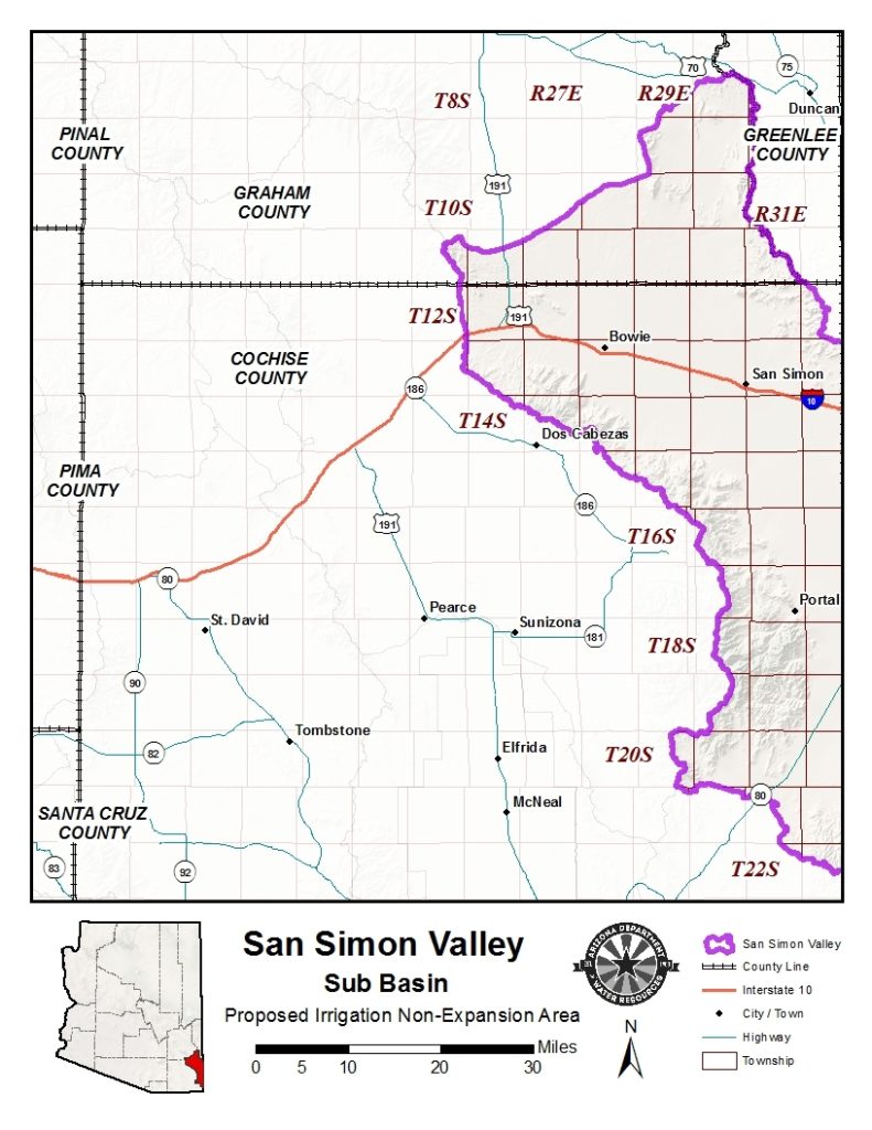
- New irrigated acreage is temporarily prohibited in the proposed San Simon Irrigation Non-Expansion Area.
- A public hearing is scheduled for October 24 in Bowie.
- State estimates show groundwater outflows are about three times greater than inflows.
- Some monitoring wells have recorded groundwater declines of more than 300 feet.
- State officials have documented land subsidence and about 26 miles of mapped earth fissures.
Friday, September 4, 2026 — A long-running effort by farmers in southeastern Arizona to place new limits on agricultural groundwater use has moved into its next stage.
The Arizona Department of Water Resources has formally started proceedings to consider designating the San Simon Valley sub-basin as an Irrigation Non-Expansion Area. The proposed area lies in southeastern Arizona along the New Mexico border, between the Peloncillo Mountains to the east and the Chiricahua, Dos Cabezas and southern Pinaleño mountains to the west.
The designation has not yet been approved. A public hearing will be held at 4 p.m. Saturday, October 24, at the Bowie High School gym in Bowie. The department will present information and accept evidence and comments both for and against the proposal.
But one important restriction is already in place: Irrigated acreage is temporarily frozen.
Effective September 2, irrigation users within the proposed area may irrigate only land that was irrigated at some point during the previous five years. That restriction will remain in effect while the department considers whether to establish the Irrigation Non-Expansion Area.
An Irrigation Non-Expansion Area does not prohibit existing agriculture. Instead, it generally prevents new acreage from being brought into irrigation, subject to limited exceptions. It also creates monitoring and reporting requirements for most groundwater withdrawals from non-exempt wells.
Under Arizona law, the Department of Water Resources director may make the designation if two conditions are met. There must be insufficient groundwater to provide a reasonably safe supply for irrigation of existing cultivated land at current withdrawal rates, and creation of an Active Management Area must not be necessary.
Farmers started the process.
Unlike a groundwater restriction imposed solely through state action, the San Simon proceeding began with a petition from irrigation users themselves.
The Department of Water Resources received the petition on September 15, 2025. State law allows such a proceeding to begin when a petition is signed by at least 25 irrigation users of groundwater or at least one-fourth of the groundwater irrigation users within the proposed area.
Because fewer than 25 entities signed the San Simon petition, the department had to determine how many groundwater irrigation users were actually operating in the sub-basin and whether the petitioners represented at least one-fourth of them.
That required considerably more than counting wells.
The department examined aerial and satellite imagery, agricultural data, county property records, state agricultural leases and well-registration records to identify irrigation occurring during the required period.
The final count was 68 groundwater irrigation users. Eighteen were determined to have validly petitioned for the designation, representing 26.5 percent of the total. That cleared the one-fourth threshold required to move forward with a public hearing.
State analysis finds a large groundwater imbalance.
A technical memorandum prepared by the Department of Water Resources on August 28 provides a clearer picture of why groundwater conditions in San Simon are under scrutiny.
The department estimates that about 13,000 acre-feet of natural recharge enters the sub-basin each year. Another 11,000 acre-feet is estimated to return to the groundwater system from irrigation, producing total estimated inflows of about 24,000 acre-feet annually.
Estimated groundwater pumping, meanwhile, is approximately 71,000 acre-feet per year, largely for agricultural irrigation. Another 5,000 acre-feet is estimated to leave underground toward the Gila Valley.
That puts estimated annual outflows at approximately 76,000 acre-feet, compared with estimated inflows of 24,000 acre-feet. In other words, the department estimates that about three times as much groundwater is leaving the system as is entering it.
The department describes the difference as persistent groundwater mining and depletion of water stored in the aquifer.
Some groundwater levels have fallen hundreds of feet
Well measurements provide another indication of changing conditions beneath the valley.
According to the August 28 memorandum, long-term monitoring shows widespread groundwater-level declines over several decades. The largest declines generally occurred near major agricultural pumping centers.
Several monitoring wells have recorded declines of more than 300 feet.
At one monitoring site, groundwater went from approximately 83 feet below the land surface in 1954 to 412 feet below the surface in 2025, a decline of 329 feet. At another, groundwater declined from 316 feet below the surface in 1963 to 620 feet in 2025, a drop of 304 feet.
The department currently has 29 active index wells in the sub-basin. Since 1986, it has also conducted six broader basin sweeps, collecting 5,968 measurements.
The ground itself is sinking.
Groundwater decline is not the only change documented in San Simon.
The Department of Water Resources says falling groundwater levels have caused portions of the aquifer to compact. When water is removed, pressure within the spaces between underground sediments decreases. Fine-grained sediments such as clay and silt can then compress, lowering the land surface.
Much of the subsidence measured in San Simon is considered irreversible, according to the department. When those underground pore spaces permanently collapse, some of the aquifer’s ability to store groundwater is also permanently lost.
Satellite measurements found more than 1.3 feet of land-surface lowering between 2010 and 2025 in some areas. Cumulative subsidence since 1996 has reached approximately 6.7 feet.
The department also reports that the rate of sinking has accelerated. Estimated deformation rates of roughly 2 to 5 centimeters per year during the late 1990s increased to more than 7 centimeters per year during the 2024-2025 monitoring period.
Earth fissures are another concern. As of April 2026, the Arizona Geological Survey had mapped approximately 26 miles of earth fissures in the San Simon Valley sub-basin.
What happens next.
The Department of Water Resources has not yet made the final decision to establish the San Simon Irrigation Non-Expansion Area.
The October 24 hearing will give the department an opportunity to present its information and allow members of the public to submit comments and evidence supporting or opposing the designation. Written comments submitted outside the hearing must be received by October 26.
The Environmental Defense Fund, which supported the growers seeking the designation, called the start of the hearing process “a major step in the right direction for family farms and local communities in the region.” The organization said the proposed Irrigation Non-Expansion Area would be a first step rather than an end to the region’s groundwater challenges.
The state technical memorandum concludes that available hydrologic data show long-term groundwater overdraft in San Simon, including declining groundwater levels, subsidence and earth fissuring. It states that if current withdrawal rates continue without increased recharge or reduced pumping, those conditions are expected to continue and potentially worsen.
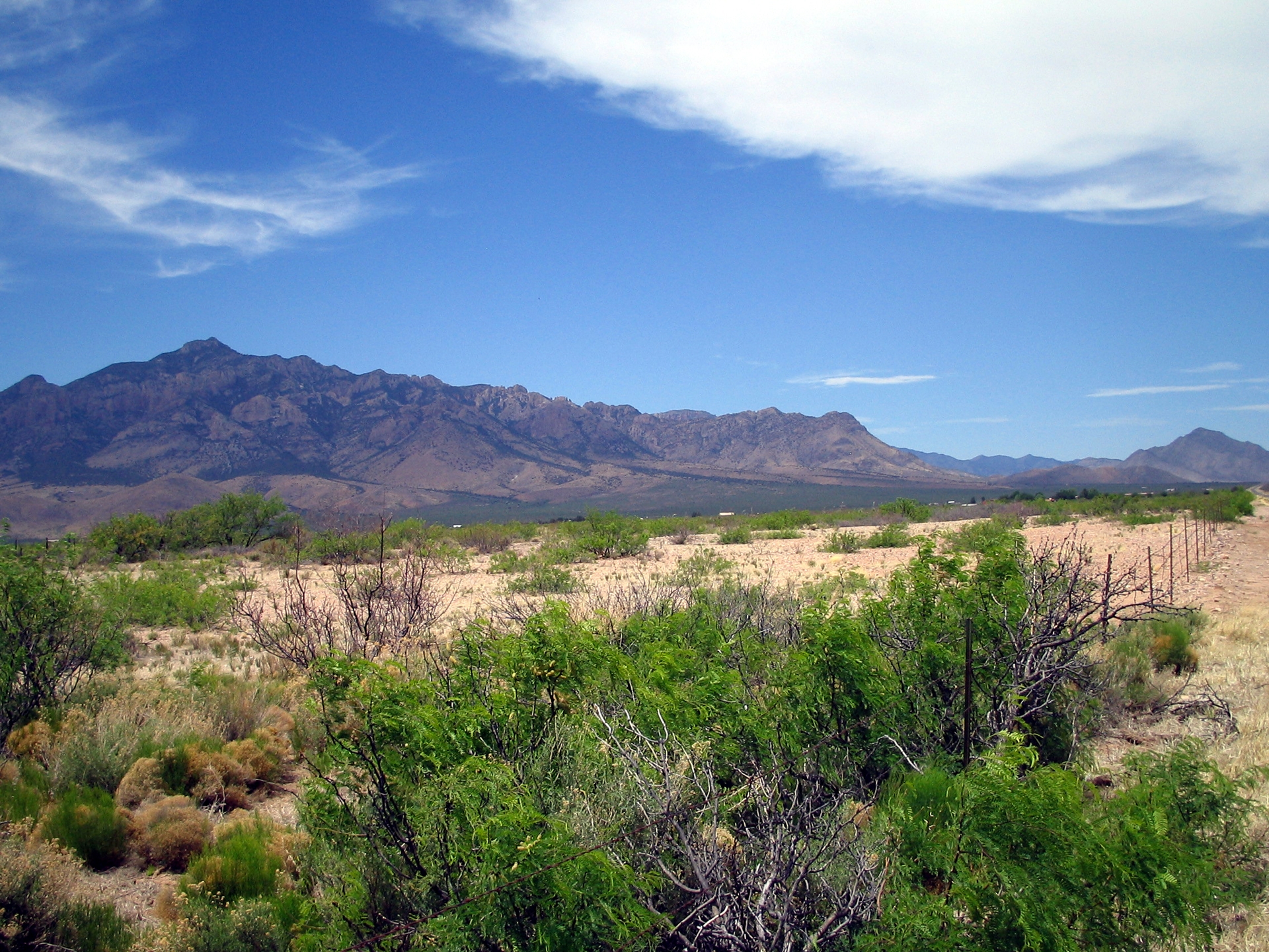
Pictured at the top: The San Simon Valley and Chiricahua Mountains — with the town of Portal, in southeastern Arizona (1962), by Karen Fasimpaur. Licensed under the Creative Commons Attribution 3.0 Unported license.



 wpDiscuz