- Lake Powell and Lake Mead reached a record combined low.
- Water shortages are hitting farms and small towns.
- National wildfire readiness rose to its highest level.
Saturday, July 18, 2026 — Beyond our own reporting this week, a clear picture emerges across the Colorado River Basin — shrinking storage, and growing strain on the people, farms, and communities that depend on it.
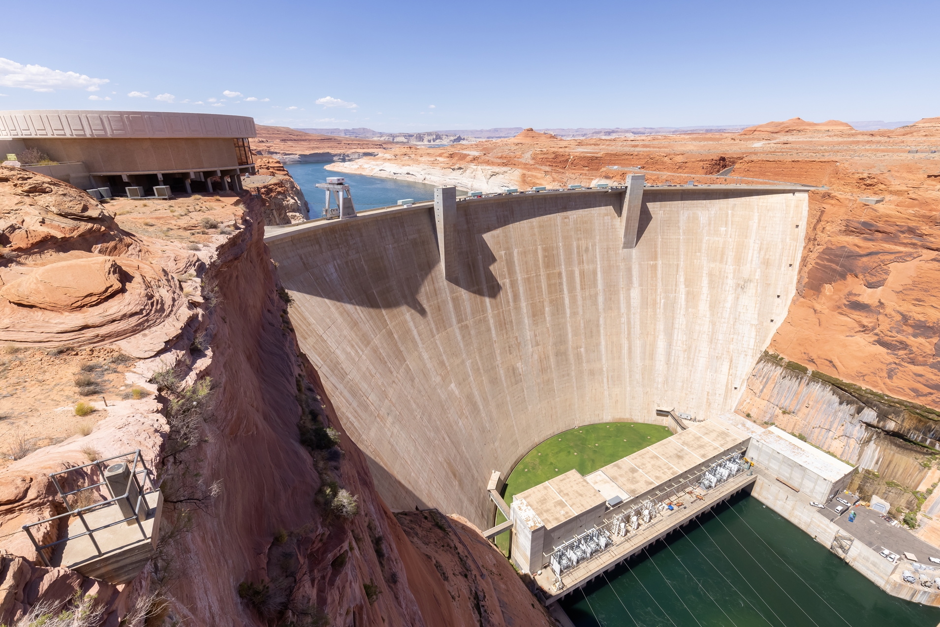
Lake Powell and Lake Mead, the two largest reservoirs in the Colorado River system, held less combined water than at any time since Lake Powell was created. Lake Powell also moved closer to the level at which Glen Canyon Dam could lose its ability to generate electricity.
At the same time, water shortages were becoming more visible across Arizona, Colorado, and Utah. Farms were left without irrigation water. Ranchers were selling livestock. One small Utah town was searching for emergency supplies.
Wildfire conditions also worsened. By the morning of July 18, the National Interagency Fire Center had raised the country to National Preparedness Level 5, the highest level. The agency reported 73 large fires that remained uncontained nationwide and more than 17,600 firefighters and support personnel assigned to active incidents.
The developments show how water shortages and wildfires can place pressure on the West at the same time. They do not affect every state, watershed or community in the same way.
Lake Powell Moves Closer to a Critical Level.
Lake Powell is approaching an elevation that could interfere with power production at Glen Canyon Dam.
The reservoir does not need to be empty for this to happen.
Water normally passes through large turbines inside the dam. The moving water spins the turbines and produces electricity. If the reservoir drops too low, there may not be enough pressure to operate those turbines normally.
This point is often called the minimum power pool.
Reaching it would not mean that all water deliveries through Glen Canyon Dam would immediately stop. Water could still be released through lower pipes built into the dam. However, those pipes were not designed to handle normal river operations for long periods.
Losing hydropower would create other problems. Electricity from the dam is sold across several Western states. Revenue from those power sales also helps pay for water projects, environmental programs and dam operations.
Federal forecasts can change as weather, runoff and water use change. Still, the low projections have placed new attention on how Glen Canyon Dam would operate if Lake Powell continues to fall.
Powell and Mead Reach a Combined Record Low.
Lake Powell and Lake Mead are often discussed separately. In practice, they are connected parts of the same river system.
Water released from Lake Powell travels through the Grand Canyon and eventually enters Lake Mead. Moving water from one reservoir to the other changes its location, but it does not increase the total supply.
The Salt Lake Tribune reported on July 17 that the combined amount stored in the two reservoirs had fallen to the lowest level recorded since Lake Powell was formed. As of July 12, Lake Powell was about 24 percent full and Lake Mead was about 27 percent full.
The combined figure offers a wider view of the river’s condition.
A rise in Lake Mead can appear encouraging if it results from a large release out of Lake Powell. However, the system as a whole has not gained water unless natural runoff or conservation adds more than is used or lost.
Both reservoirs serve important but different purposes.
Lake Powell helps the Upper Basin states of Colorado, New Mexico, Utah, and Wyoming meet their obligations to send water downstream. It also supports electricity production at Glen Canyon Dam.
Lake Mead stores water used by Arizona, California, Nevada, Mexico, tribes, and irrigation districts. Its elevation also helps determine whether mandatory water cuts are imposed under the current operating rules.
The seven Colorado River Basin states have not yet agreed on long-term rules to replace the current system after 2026. Low reservoir levels make that disagreement more urgent, but they do not decide how future reductions will be divided.
Water Shortages Reach Farms and Small Towns.
The reservoir crisis can appear distant when it is described in millions of acre-feet. Conditions reported last week showed what declining water supplies can mean at the community level.
Reuters reported July 15 that San Carlos Reservoir in Arizona had fallen to about 1 percent of capacity. In early June 2026, drought conditions, combined with water releases from the dam, resulted in a major fish kill affecting approximately 100% of the fish population within the lake. The reservoir is located on the Gila River, which is part of the larger Colorado River system.
Near Casa Grande, farmer Nancy Caywood was left without irrigation water in March. Her approximately 250-acre farm produces alfalfa and cotton.
Caywood still faced a $21,000 yearly water-district charge even though no river water was available for her farm. She leased nearby fields with access to groundwater so she could continue growing crops.
Another Pinal County farmer, Jace Miller, had left more than half of his fields unused. Miller’s family has farmed in the area for more than a century.
Housing developers and solar companies were buying land that he had leased for agriculture. Miller argued that the state should protect farmland and consider new water sources rather than continue shifting supplies away from agriculture.
Others hold a different view.
A Scottsdale City Council candidate told Reuters that water historically used by agriculture might be available for cities. Scottsdale receives about 70 percent of its supply from the Colorado River and has been looking for additional sources.
These statements reflect a larger debate over how limited water should be divided among farms, existing communities and new development.
The issue is not settled by simply deciding which use is most valuable. Water rights, contracts, pumping laws and delivery systems determine who can legally and physically use water.
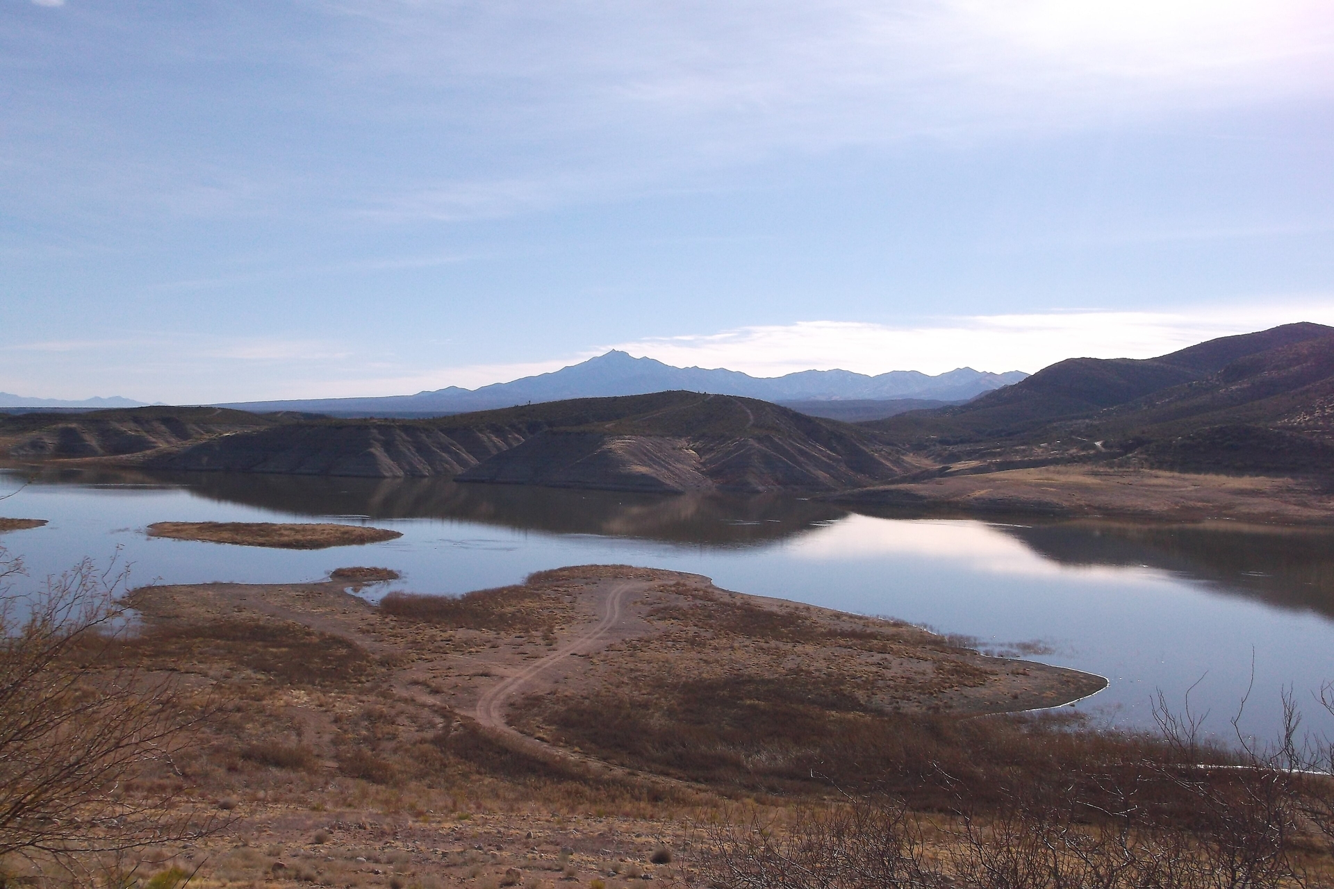
 , by Sammy 101. Licensed under the Creative Commons Attribution-Share Alike 3.0 Unported license.
Groundwater Offers Help, but Not a Simple Answer.
When river water disappears, farms and cities often look underground.
Groundwater is stored in spaces between soil, sand and rock. Wells can provide water during dry periods, but not every aquifer refills quickly.
Colorado State University water scientist Brad Udall told Reuters that Arizona’s large groundwater reserves should not be treated as a renewable supply.
Heavy pumping can lower the water table. That can make wells more expensive to operate and may cause shallower wells to fail.
In some areas, groundwater pumping also reduces water that would otherwise enter rivers and streams. It can cause land to sink when underground layers collapse as water is removed.
Groundwater conditions usually cannot be measured through a single weekly report. Water levels may change slowly, and readings can vary depending on the season and nearby pumping.
For that reason, groundwater trends are generally more useful when studied over months or years.
Colorado Ranchers Face an Early End to Irrigation.
Water shortages also reached Colorado’s Western Slope.
Reuters reported that rancher Robbie LeValley produced only about one-quarter of her normal hay crop after snowmelt irrigation water ended two months early.
Hay prices in the region had reportedly tripled. LeValley sold one-fifth of her cattle as stock ponds dried and feed became more expensive.
Agriculture is one of the largest water users in the Colorado River Basin. It also supports rural communities, food production, and open land.
Cities and industrial users have different needs. Municipal water systems must provide reliable supplies for homes, businesses, schools, hospitals, and fire protection.
The competing needs have become part of the debate over future Colorado River reductions. The amount of water physically available is only one part of that discussion. Legal rights and priorities also matter.
A Utah Town Searches for Emergency Water.
The shortage is especially serious in Emery, Utah, a town of about 330 people.
Muddy Creek is the community’s only drinking-water source. Reuters reported that the creek was flowing at about 6 percent of its normal volume following extremely low mountain snowpack.
Outdoor watering had been banned. Residents were reusing water from baths and dishwashing to keep trees and gardens alive.
Mayor Jack Funk estimated that the town’s stored water might last another six to nine months. Officials were testing old wells and springs as possible backup sources.
Without new precipitation or another supply, the town could eventually need to bring water in by truck.
The situation in Emery shows why a water shortage can be more difficult for a small town than a large city. Larger systems may have several reservoirs, wells, treatment plants and connections with neighboring suppliers.
A small rural community may depend on one creek, spring, or well field. When that source fails, the town may have few affordable alternatives.
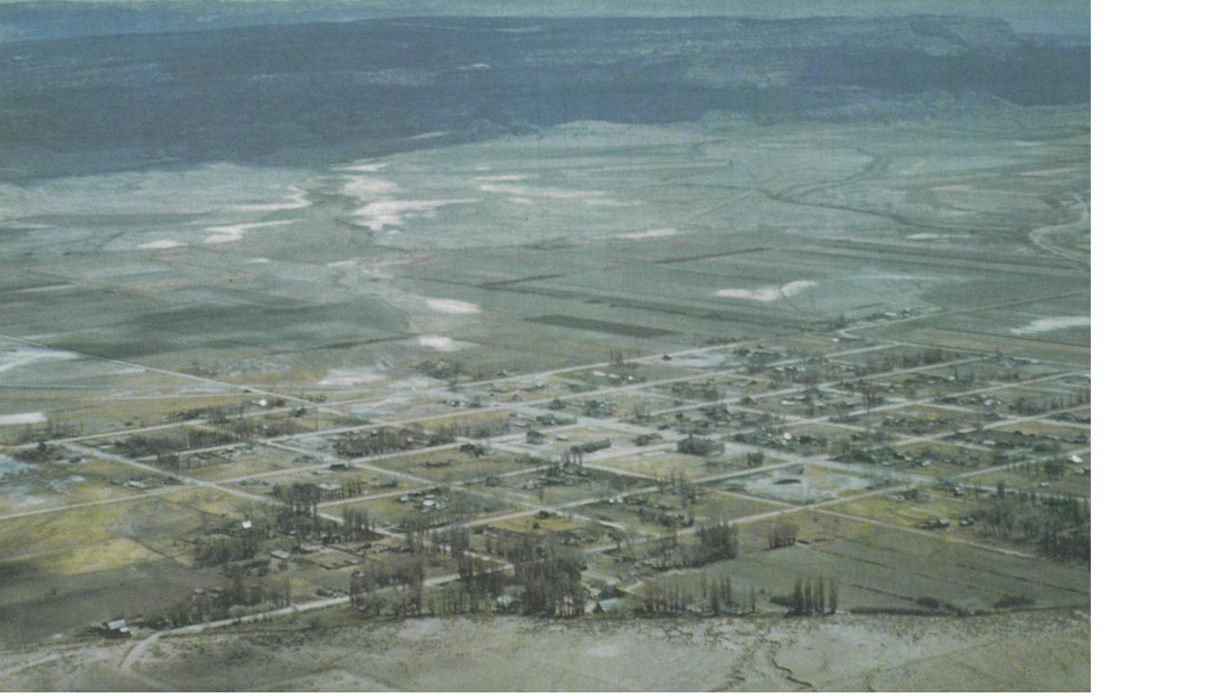
 , circa 1950s. Public Domain
Evaporation Study May Improve Water Accounting.
Water managers are also studying how much water disappears from Upper Basin reservoirs through evaporation.
A new project will examine Flaming Gorge Reservoir, which stretches across Utah and Wyoming. The work is expected to improve estimates of how much stored water is lost to the atmosphere.
Evaporation changes with wind, heat, humidity, water temperature and the size of the reservoir’s surface. Ice cover and seasonal water levels also matter.
Older estimates may rely on weather stations located far from the reservoir or on formulas that do not fully reflect local conditions.
Flaming Gorge has become especially important because stored water can be released into the Green River and eventually flow into Lake Powell.
A more accurate evaporation estimate could help managers calculate how much of a release is likely to remain in the river system. It could also improve comparisons among reservoirs.
The study does not show that previous estimates were necessarily wrong. It is intended to provide better measurements at a time when smaller amounts of water carry greater importance.
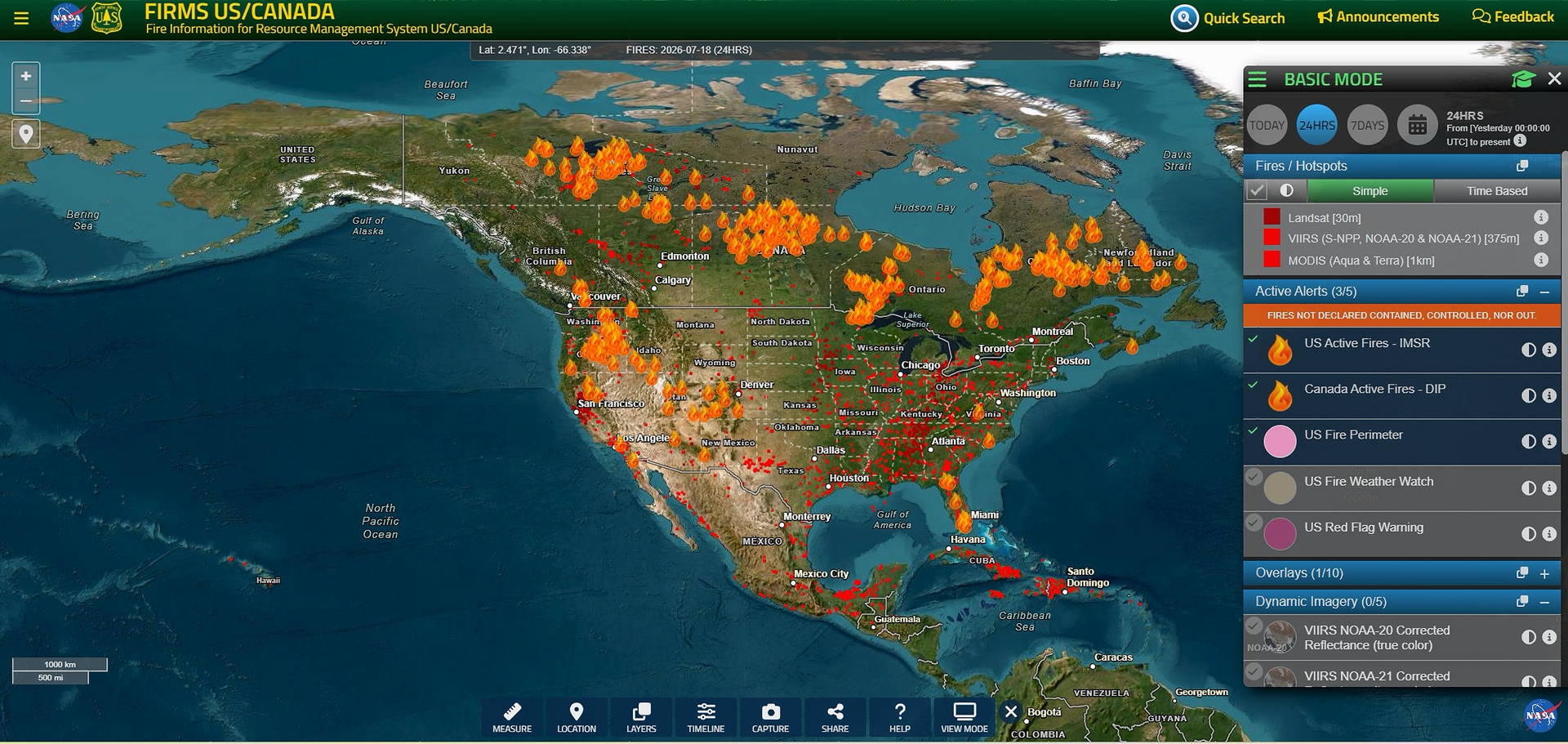

Wildfire Readiness Reaches High Level.
Wildfire activity increased sharply by the morning of July 18.
The National Interagency Fire Center raised the country to Preparedness Level 4, placing heavy demand on crews, aircraft and management teams.
The agency reported:
- 212 new fires.
- 17 new large incidents.
- 73 large fires that remained uncontained.
- 23 major incident-management teams assigned.
- 17,683 firefighters and support personnel working nationally.
Military air tankers and support crews had also been deployed to help with firefighting operations.
Preparedness Level 5 does not describe the danger at one particular fire. It measures the strain on national firefighting resources.
Arizona Fire Near Sedona Reaches 95 Percent Containment.
The Pocket Fire, about seven miles north of Sedona, remained at 27,393 acres on July 18.
Containment had reached 95 percent. Fire activity was described as minimal, with creeping and smoldering.
Rain had fallen over the fire area, but road, trail, and area closures remained in effect.
Rain can help slow a wildfire. It can also create new concerns after vegetation has burned away.
A strong storm over severely burned slopes can send mud, rocks, ash, and burned wood into roads, streams, and communities. The danger depends on the intensity of the burn, the steepness of the land, and the amount of rain.
Colorado Carries Several Major Fires.
Colorado continued to have the largest group of major fires among the seven Colorado River Basin states.
- The Aspen Acres Fire southwest of Pueblo reached 100,224 acres and was 61 percent contained. The fire had destroyed 915 structures. Evacuations and road, trail and area closures remained in effect.
- The Gold Mountain Fire near Ouray remained at 37,734 acres and 13 percent containment. Homes and other important infrastructure were threatened.
- The Elk Fire northwest of Lake City remained at 2,199 acres with no containment reported. Evacuations and closures were in effect.
- The Ferris Fire east of Cahone remained at 64,881 acres and had reached 71 percent containment.
- The Willow Fire west of Leadville grew to 6,967 acres and remained 37 percent contained.
- The P L Gulch Fire southwest of Meeker was listed at 1,580 acres and 15 percent containment. Officials said the smaller acreage estimate resulted from more accurate mapping.
Large fires can affect water long after the flames are controlled. Severe burns may leave soil unable to absorb rain. Ash and sediment can then wash into streams and reservoirs.
The size of a fire alone does not show how much water damage will occur. Burn severity, location, and later storms are also important.
Utah Fires Continue Across Large Areas.
The Babylon Fire southwest of Monticello remained Utah’s largest listed incident at 107,173 acres. Containment had improved to 82 percent by July 18.
The fire continued to threaten important infrastructure. Road, trail and area closures remained in place. Five structures had been lost.
The Cottonwood Fire east of Beaver covered 97,464 acres and was 90 percent contained. Evacuations and closures remained in effect. The fire had destroyed 185 structures.
The Stookey Fire west of Vernon covered 10,337 acres and was 15 percent contained. Energy infrastructure remained threatened.
The smaller Buck Basin Fire east of Heber City was 96 percent contained at 145 acres. Communications equipment had been threatened.
Fires Improve in Nevada and California.
The 18 Mile Fire in northeastern Nevada reached 100 percent containment at 1,326 acres.
Because the fire was far from Lake Mead and the Las Vegas Valley, it was a statewide wildfire development rather than a direct threat to Southern Nevada’s main water system.
In California, the Elephant Fire northeast of Loyalton grew to 13,695 acres and was 85 percent contained. Homes remained threatened.
The Thorn Fire in San Diego County was 75 percent contained at 1,234 acres.
The Summit Fire west of Pinon Hills remained at 2,690 acres and 95 percent containment. Five structures had been lost.
Some of these California fires were outside the Colorado River watershed. They still matter to the basin because California shares firefighting crews, aircraft and management teams across the state.
New Mexico Fire Remains at 80 Percent Containment.
The Sacaton Fire east of Glenwood, New Mexico, remained at 9,861 acres and 80 percent containment.
Fire behavior was described as minimal, with smoldering and creeping. One structure had been lost.
The fire was outside the main Colorado River drainage. However, it remained important to New Mexico’s statewide firefighting resources and nearby rural watersheds.
Wyoming Code Refers to a Colorado Fire.
The Fishhook Fire carried a Wyoming agency code in the federal report because it was managed by the Medicine Bow-Routt National Forest.
The fire itself was located northwest of Steamboat Springs, Colorado.
It covered 347 acres and had no reported containment on July 18. Structures were threatened, and road, trail and area closures were in effect.
The difference is important when reading federal wildfire reports. A fire’s agency code may identify the office managing the incident rather than the state where it is physically located.
Curated Source Roundup:
The Washington Post
Headline: “A major Colorado River reservoir is getting ‘perilously’ low”
Publication date: July 16, 2026
Area: Lake Powell; Colorado River Basin
Summary: Examines federal projections showing Lake Powell approaching the elevation at which Glen Canyon Dam could lose its ability to generate hydropower.
Reuters
Headline: “In US West, drought pits farms against towns, industry in scramble for water”
Publication date: July 15, 2026
Area: Arizona, Colorado and Utah; broader Colorado River Basin
Summary: Documents how depleted reservoirs, low streamflow and groundwater dependence are sharpening competition among agriculture, cities, housing and industrial development.
The Salt Lake Tribune
Headline: “The Colorado River’s 2 biggest reservoirs just hit a new record low”
Publication date: July 17, 2026
Area: Lake Powell and Lake Mead
Summary: Reports that combined storage in the Colorado River’s principal reservoirs fell to a historic low, emphasizing that transfers between the reservoirs do not correct the overall storage deficit.
https://www.sltrib.com/news/environment/2026/07/17/combined-storage-lake-powell-lake/
The Salt Lake Tribune
Headline: “How much water does Flaming Gorge actually lose to evaporation? Water managers may finally find out.”
Publication date: July 13, 2026
Area: Utah and Wyoming; Upper Colorado River Basin
Summary: Describes a new effort to improve evaporation measurements at Flaming Gorge and other Upper Basin reservoirs.
https://www.sltrib.com/news/environment/2026/07/13/new-evaporation-study-launches/
Associated Press
Headline: “Hand crews, engines and air tankers join forces in wildfire chess game”
Publication date: July 14, 2026
Area: Western United States
Summary: Explains how the heavy 2026 fire season is stretching crews, aircraft and incident-management teams and forcing managers to balance resource sharing against local risk.
National Interagency Fire Center
Headline: “Incident Management Situation Report”
Report date: July 17, 2026; latest available early July 18
Area: National, with detailed entries for the seven Colorado River Basin states
Summary: Primary federal source for the updated acreage, containment, structures lost, threats, evacuations, closures and assigned resources reported above.
https://www.nifc.gov/nicc-files/sitreprt.pdf
National Interagency Fire Center
Headline: “National Fire News”
Status checked: Morning of July 18, 2026
Area: National and Western United States
Summary: Provides national preparedness status, incident totals and resource information. The page still displayed July 17 statistics early Saturday morning.
https://www.nifc.gov/fire-information/nfn
Publication note: As of the Saturday-morning check, the National Interagency Fire Center had not yet posted a July 18 national situation report. The fire figures above, therefore, use the July 17 report—the latest official national snapshot available—and the article states that timing clearly.