- Lake Mead fell to 1,040.5 feet on August 7, 2026, its lowest level on record.
- The reservoir has dropped every day since July 31, 2026.
- The previous record low of 1,040.58 feet was set on July 28, 2022.
- Bureau of Reclamation figures show the lake sliding steadily lower through 2026.
Friday, August 7, 2026 — Lake Mead, the largest reservoir in the United States, has sunk to the lowest level ever recorded. According to USA TODAY , the giant lake formed by Hoover Dam on the Colorado River, just outside Las Vegas, dropped to 1,040.5 feet today. That figure edged past the old mark of 1,040.58 feet, which was set on July 28, 2022. The lake had climbed back up after that earlier scare, helped by several wetter winters, but it has been sliding again. Bureau of Reclamation records show the level has fallen every single day since July 31, 2026. The reservoir sends water to tens of millions of homes, businesses and farms, and its dam also produces hydroelectric power. The new low arrived just days after federal officials released a plan to handle water shortages.
What the Elevation Numbers Reveal.
The Bureau of Reclamation has tracked Lake Mead’s height since crews first began filling it in the 1930s. Its end-of-month records, last updated on August 3, 2026, help show how far the water has swung over the years. Back in 2020, the lake closed several months above 1,090 feet. Then came a steep slide. By the end of July 2022, the reservoir sat at about 1,040.92 feet, right near its record low. The wetter winters that followed brought a partial rebound, and the lake finished 2023 close to 1,068 feet.
The relief did not last. In 2026, the numbers turned downward again, month after month. The lake measured 1,065.37 feet at the end of January, then dropped through the spring and into summer: 1,056.32 feet in April, 1,050.00 feet in May, 1,044.58 feet in June and 1,041.10 feet at the end of July. Across the years in the record, the lake tends to lose height through the spring and summer stretch, and in 2026 that downward path carried it into new record territory. By August 7, 2026, the level had slipped to 1,040.5 feet.
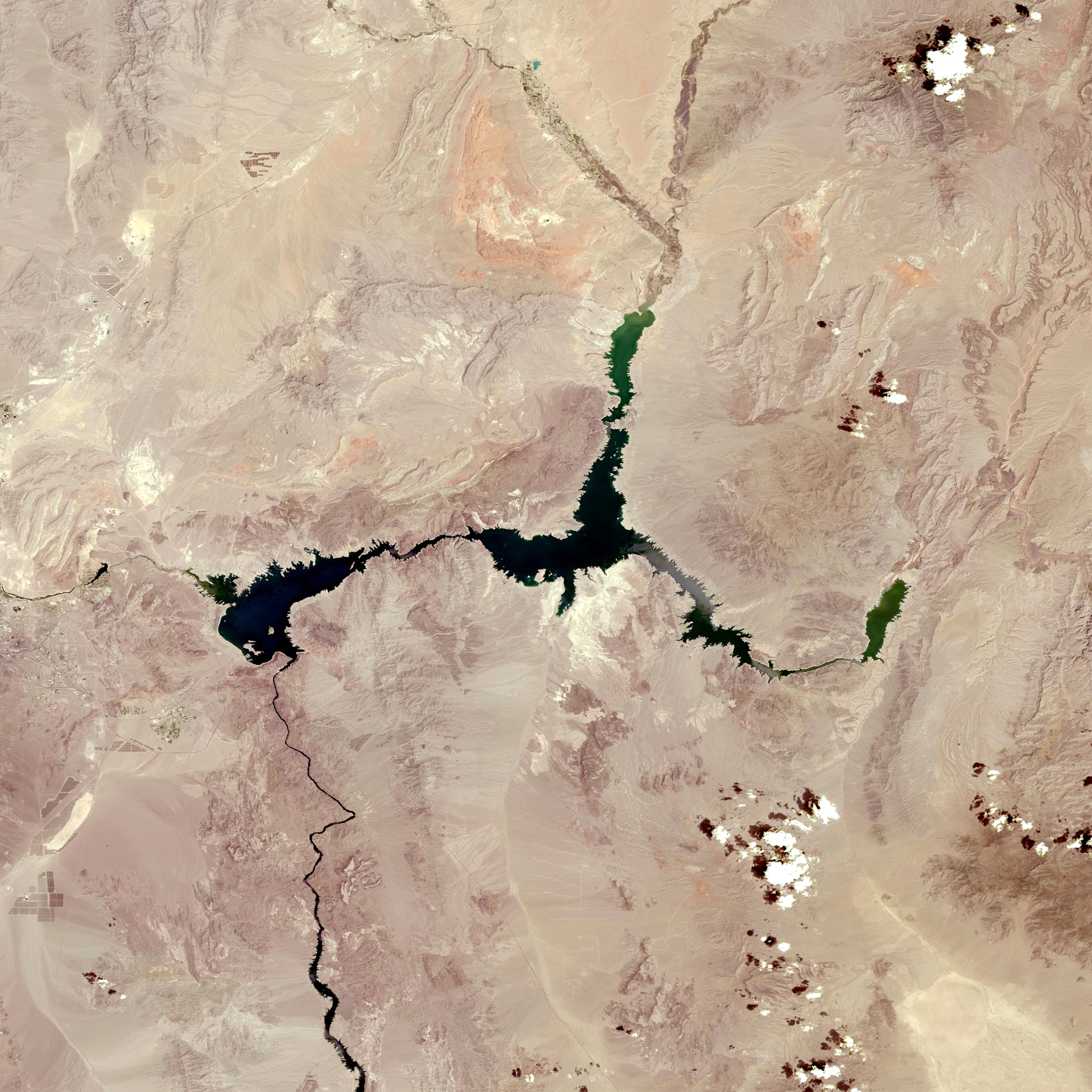
Pictured: The OLI instrument onboard the Landsat 8 satellite captured this true color image of Lake Mead on July 19, 2022 during the 2020-22 North American drought. NASA/USGS, public domain.