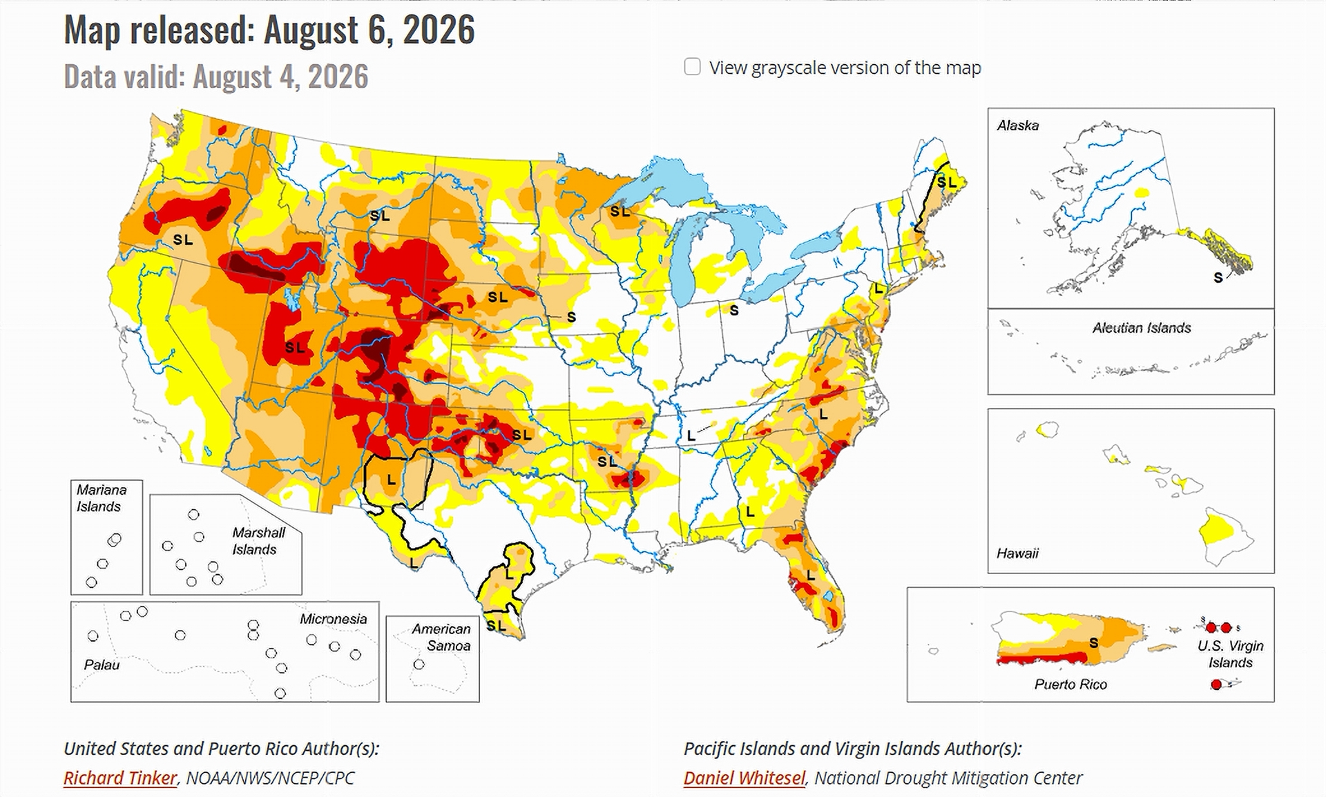
- Monsoon storms brought scattered relief to Arizona and New Mexico.
- Extreme and exceptional drought still cover much of Colorado and Wyoming.
- A new area of exceptional drought appeared in the Denver metro region.
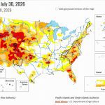
Saturday, August 8, 2026 —The U.S. Drought Monitor released its latest update this week, and the map told two very different stories. In the East and across much of the Midwest, moderate to heavy rain fell on dry ground and eased drought in many places. A few areas even flooded. Still, the report noted that drought stayed stubborn in parts of the East, where low groundwater and tight water supplies held back bigger gains.
The West looked nothing like that. From the Rockies to the Pacific, rain was hard to find. The one exception was the Southwest monsoon, which dropped steady rain, and a few totals above two inches, on parts of New Mexico and Arizona. Across the rest of the Intermountain West, the Great Basin, and California, very little rain fell. The report pointed out that this is a naturally dry time of year for much of that ground. Outside the Pacific Northwest, temperatures ran above normal.
The Colorado River Basin.
The seven states that share the Colorado River, which are Arizona, California, Colorado, Nevada, New Mexico, Utah, and Wyoming, headed into the weekend with a split picture. Rain reached the southern edge of the basin. The northern and central parts, led by Colorado and Wyoming, stayed buried in some of the harshest drought in the country.
Relief in the Southern Basin.
A strong monsoon flow carried moisture into the lower basin. Southern and eastern New Mexico, southeastern Arizona, and the higher parts of central Arizona all picked up moderate to locally heavy rain. A few showers even reached southern Utah.
Those rains led to small pockets of improvement. The report listed gains in west-central New Mexico, parts of southeastern Arizona, some higher ground farther north in that state, and a few spots across Utah.
Colorado and Wyoming Stay Dry.
Farther north, the drought would not let go. Most of Colorado and most of Wyoming stayed in extreme drought (D3), the second-worst level on the scale. The worst level, exceptional drought (D4), held firm in east-central Colorado and in the south-central and interior western parts of the state.
The report also marked a fresh patch of exceptional drought (D4) in part of the Denver metro region.
Conditions were not the same everywhere. Northeastern Colorado and northeastern Wyoming slipped backward, while southeastern Colorado and western Wyoming gained ground. Humidity stayed below normal across most of Colorado, a condition the report tied to a faster loss of moisture from the soil.
California and Nevada Hold Steady.
In the far western basin, little changed. The report called the dry, warm weather fairly normal for July, and drought levels in California and Nevada stayed the same as the week before. Cooler readings, near or below normal, were limited to central and northern California and western Nevada. Most other spots ran warm.
The Days Ahead.
The report offered some hope for the southern basin. Its short-range outlook called for one to two inches of rain in southeastern Arizona and some higher parts of the state, with monsoon moisture bringing light to locally moderate rain to parts of Arizona and New Mexico in the coming days. Across the rest of the West, little or no rain was expected. Heat was another matter. Much of the region, including most of Colorado, was forecast to run 5 to 11 degrees above normal.
Next week looks a bit wetter for the Southwest. The report gave better-than-even odds for well-above-normal rain in the zone under the monsoon, running from Arizona through most of Utah, into eastern Nevada and the southeastern California deserts. At the same time, warmer-than-usual weather was favored from the Rockies west to the Pacific coast.