- The Bureau of Reclamation released its Final Environmental Impact Statement for future Colorado River operations on July 31, 2026.
- The plan sets a flexible 10-year framework for running Lake Powell and Lake Mead through 2036.
- Arizona would carry the largest share of Lower Basin water cuts, while California is shielded when shortages are smaller.
- The framework allows Lower Basin shortages of up to 3.0 million acre-feet in dry years.
- The seven states and Mexico still have not reached a consensus deal, so the federal government acted to have rules ready by October 1, 2026.
Friday, July 31, 2026 — The Colorado River is running low, and the two giant reservoirs that store its water are running lower. Today, the Bureau of Reclamation, the federal agency that manages the river’s big dams, released a long-awaited document called the Final Environmental Impact Statement. In plain terms, it is the government’s plan for how Lake Powell and Lake Mead will be operated once the current rules run out at the end of 2026.
The stakes are hard to overstate. The Colorado River supplies drinking water and power for more than 40 million people across seven states. It waters roughly 5.5 million acres of farmland. It serves 30 Native American tribes and two states in northern Mexico. When the river shrinks, all of those users feel it.
And the river has been shrinking for a long time. According to the Final Environmental Impact Statement, the Basin has lived through one of the worst multi-decade droughts in the last 1,200 years, stretching back to the year 2000. This year has been especially brutal. The document notes that the region is likely seeing its lowest snowpack since record-keeping began in the 1930s. As of the plan’s publication, the combined water stored in Lake Powell and Lake Mead sat at about 12.5 million acre-feet. That is a low point not seen since before Glen Canyon Dam started filling Lake Powell back in 1963.
What the Final Plan Actually Does.
The plan does not lock in one fixed set of cuts for the next ten years. Instead, it builds what the Bureau of Reclamation calls an adaptive decision framework. Think of it as a set of guardrails rather than a single road. Within those guardrails, the government would write shorter operating guidelines, expected to run in two-year chunks, that can be adjusted as conditions change through 2036.
The guardrails, which the plan calls sideboards, include a few key limits. Annual releases from Lake Powell can range from 5.0 million acre-feet to 12.0 million acre-feet. Lower Basin shortages can reach up to 3.0 million acre-feet to protect the critical machinery at Hoover Dam during dry stretches. Water users can store conserved water, up to 3.0 million acre-feet in Lake Powell and up to 8.0 million acre-feet in Lake Mead, to save for later. Upper Basin users can also volunteer to conserve up to 200 thousand acre-feet a year, depending on how wet or dry the year is.
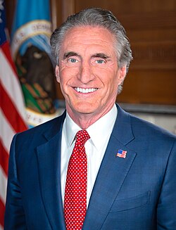
Interior Secretary Doug Burgum framed the plan as a way to keep the system steady while leaving room for the states to strike their own bargain. “The Department has a responsibility to ensure the Colorado River system remains reliable and resilient for the millions of Americans, communities and industries that depend on it,” Burgum said. “This framework provides the flexibility to respond to changing hydrologic conditions while preserving the opportunity for the Basin States to continue working toward durable, consensus-based solutions.”
Why the Math No Longer Works.
The trouble with the Colorado River comes down to a promise made a century ago that the river can no longer keep. The Colorado River Compact of 1922 split the river between an Upper Basin and a Lower Basin, handing each 7.5 million acre-feet of water per year. That split was based on the best guess at the time, an estimated average flow of about 18 million acre-feet a year, measured over the years from 1906 to 1921.
The river has not delivered that much in a long while. According to the plan, inflows from 2000 to 2024 averaged only 12.9 million acre-feet. This year has been far worse. The unregulated inflow into Lake Powell as of July was estimated at just 3.5 million acre-feet.
Meanwhile, people keep using more than the river provides. Between 2020 and 2024, average water use in the Basin ran about 13.1 million acre-feet a year. The Bureau of Reclamation breaks that down as 6.5 million acre-feet in the Lower Basin, which is 49 percent of the total, and 3.8 million acre-feet in the Upper Basin, or 29 percent. Mexico used 1.4 million acre-feet, and evaporation swallowed another 1.4 million acre-feet, each about 11 percent. Since 2000, water use has topped the river’s total inflow in most years. That is the core of the problem. More is going out than is coming in.
The pressure grew so severe that in the spring of 2026 the Department of the Interior took emergency steps. It released an extra 660,000 to 1 million acre-feet from the Flaming Gorge reservoir upstream, and it cut releases from Lake Powell to the Lower Basin down to 6 million acre-feet, a reduction of 1.5 million acre-feet. Those moves kept Lake Powell above the critical elevation of 3,490 feet, the level below which Glen Canyon Dam can no longer send water through its power turbines.
How the Cuts Would Be Shared.
Because the plan is a framework, it does not spell out exact cuts for every year. To show what the rules might look like in practice, the Bureau of Reclamation modeled a version it calls the Representative Preferred Alternative. That model shows how shortages would be split among the states and Mexico.
The sharing follows two different systems depending on the year. For 2027 and 2028, shortages up to 1.5 million acre-feet would be divided using a proposal the three Lower Division States submitted on May 1, 2026. Anything above 1.5 million acre-feet would fall under the older priority system. From 2029 onward, all shortages would follow the priority system unless the states reach new agreements.
The priority system matters because it decides who gets cut first. Under federal law, junior water rights created after 1968, which include much of the Central Arizona Project that serves Phoenix and Tucson, must be reduced before California’s older rights are touched. That single rule explains why the numbers land so unevenly on Arizona.
Here is a concrete example from the model. If the Lower Basin as a whole faced a shortage of 1.5 million acre-feet in 2027 or 2028, the water would be divided this way: Arizona would give up 760 thousand acre-feet, California would give up 440 thousand acre-feet, Nevada would give up 50 thousand acre-feet, and Mexico’s share of the reduction would be 250 thousand acre-feet.
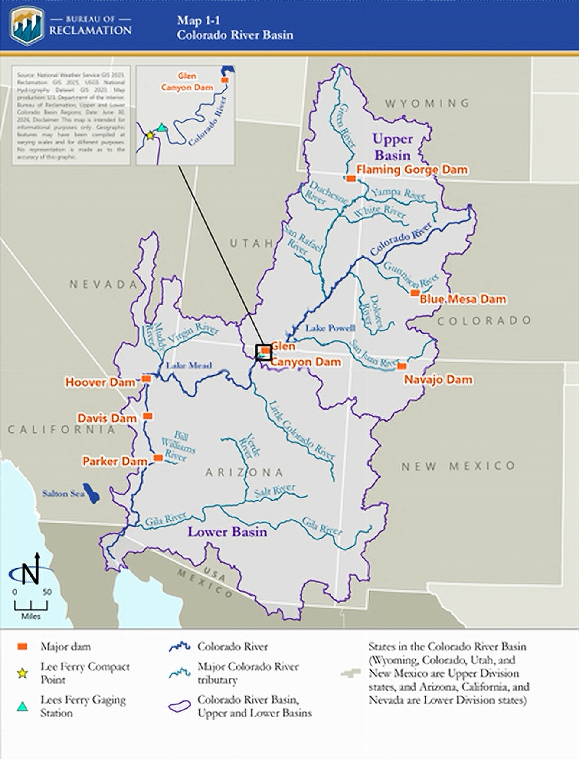
A State-by-State Look at the Proposed Cuts.
The following breakdown reflects the shortage sharing modeled in the Representative Preferred Alternative. These figures are modeling assumptions, not final mandates, and the actual guidelines for each two-year period would be set within the plan’s sideboards.
Arizona.
Arizona takes the heaviest hit of any state. In 2027 and 2028, it would absorb 80 percent of the first 300 thousand acre-feet of Lower Basin shortage and 43.33 percent of the next slice up to 1.5 million acre-feet. For deeper shortages between 1.5 million and 2.344 million acre-feet, Arizona’s share climbs to 76.26 percent. From 2029 through 2060, Arizona would carry 77.40 percent of the first 1.814 million acre-feet of shortage. Its low-priority Central Arizona Project supply is the reason it stands first in line for reductions.
California.
California is largely protected when shortages are smaller, thanks to its senior water rights. In 2027 and 2028, it would face no cut on the first 300 thousand acre-feet, then 36.67 percent of the slice up to 1.5 million acre-feet. It again drops to zero in the 1.5 million to 2.344 million acre-feet range. Only in the deepest shortages, above 2.345 million acre-feet, does California’s share jump to 45.16 percent. From 2029 through 2060, California would take zero of the first 1.814 million acre-feet, then 51.63 percent of everything above that.
Colorado.
Colorado is an Upper Division State, and the framework does not impose mandatory Lower Basin shortage cuts on it. Instead, Upper Basin states can contribute through voluntary conservation of up to 200 thousand acre-feet a year, stored in a Lake Powell pool that can reach 3.0 million acre-feet and shared with Upper Basin tribes. Under the 1948 Upper Colorado River Basin Compact, Colorado holds the largest Upper Basin share at 51.75 percent of the water available for use.
Nevada.
Nevada carries the smallest share among the Lower Division States because its overall allotment is small. In 2027 and 2028, it would give up 3.33 percent of the first 1.5 million acre-feet of shortage, rising to 7.08 percent for deeper cuts. From 2029 through 2060, Nevada’s share would be 5.93 percent. Nearly all of Nevada’s Colorado River water goes to homes and businesses through the Southern Nevada Water Authority near Las Vegas.
New Mexico.
New Mexico is an Upper Division State and does not face mandatory Lower Basin cuts under the framework. It can join the voluntary Upper Basin conservation efforts described above. Its share of Upper Basin water under the 1948 compact is 11.25 percent.
Utah.
Utah is also an Upper Division State without mandatory Lower Basin shortage cuts in the plan. Like its neighbors, it can take part in voluntary conservation stored in Lake Powell. Utah’s share of Upper Basin water under the 1948 compact is 23 percent.
Wyoming.
Wyoming rounds out the Upper Division States and likewise faces no mandatory Lower Basin cuts under the framework. It can contribute through voluntary conservation. Wyoming holds 14 percent of the Upper Basin’s water under the 1948 compact.
Mexico is not one of the seven states, but its water deliveries appear in the model at 16.67 percent of shortage across every tier. The plan stresses that these are modeling assumptions only. Actual deliveries to Mexico are handled separately under the 1944 Water Treaty through the International Boundary and Water Commission, in step with the U.S. Department of State.
Saving Water for a Dry Day.
The plan leans heavily on conservation and storage as tools to stretch the supply. Water users would be able to bank conserved water in the two big reservoirs and pull it out later when they need it. The plan allows storage of up to 3.0 million acre-feet in Lake Powell and up to 8.0 million acre-feet in Lake Mead. That larger Lake Mead figure includes existing conservation programs, along with new mechanisms and a federally managed pool.
These kinds of voluntary agreements have already made a real difference. The plan credits past conservation deals with lifting Lake Mead roughly 150 feet higher than it would otherwise sit, and it notes that more conservation is planned in the years ahead.
Still No Basin-Wide Deal.
Running through the entire document is a note of frustration. For years, the federal government has pushed the seven states and the tribes to negotiate their own long-term agreement, believing a deal shaped by the water users themselves would hold up better than one handed down from Washington.
That deal has not come together. Reclamation released a Draft Environmental Impact Statement in January 2026 without naming a preferred path, on purpose, to give the states more time to talk. After another six months of negotiations, no long-term consensus emerged. With new operations required to begin October 1, 2026, the government moved ahead and named its preferred framework.
Public interest has been intense. After the draft came out in January 2026, Reclamation received more than 18,000 comments, including 785 unique submissions from the public, tribes, states, and federal agencies. The agency says that input helped shape the final preferred alternative.
Assistant Secretary for Water and Science Andrea Travnicek described the plan as an attempt to give water users both stability and room to maneuver. “This plan strikes a balance between flexibility and predictability for the Colorado River system that is vital to the 40 million people who rely on it given unprecedented hydrologic conditions and the potential for considerable impacts on water users,” she said. “It also allows a new flexibility to respond to changing conditions and potential consensus.”
What Comes Next.
The framework preserves a door for the states to keep talking. If they reach a consensus agreement, it can be folded into future operations. Until then, the federal government would issue operating guidelines in roughly two-year intervals, reviewing and updating them as the drought evolves.
The Final Environmental Impact Statement covers only operations inside the United States. A separate process addressing water deliveries to Mexico is nearing completion and will move through the International Boundary and Water Commission.
For the millions of people who turn on a tap, water a field, or flip on a light powered by the Colorado River, the message from the plan is steady and sobering. The river is smaller than the promises made on it, and the years ahead will ask everyone who depends on it to make do with less.